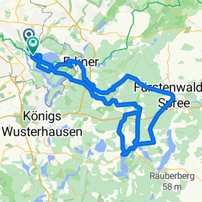
Ersatzrunde für Rund um den Scharmützelsee
- 134.6 km
- 353 m
- 349 m
- Köpenick, State of Berlin, Germany
A cycling route starting in Köpenick, State of Berlin, Germany.
Overview
-generally good asphalt, sometimes a bit bumpy, but in Berlin/Brandenburg, perfect roads are rare
created this 14 years ago
Route quality
Road
24.9 km
(20 %)
Quiet road
18.7 km
(15 %)
Paved
105.8 km
(85 %)
Asphalt
99.5 km
(80 %)
Concrete
6.2 km
(5 %)
Undefined
18.7 km
(15 %)
Route highlights
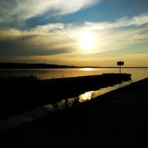
lecker Kuchen :)
Continue with Bikemap
You would like to ride Ausflug in die Märkische Schweiz or customize it for your own trip? Here is what you can do with this Bikemap route:
Free trial for 3 days, or one-time payment. More about Bikemap Premium.
Discover more Premium features.
Get Bikemap PremiumFrom our community
Open it in the app