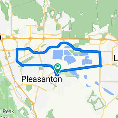
- 47.9 km
- 494 m
- 491 m
- Pleasanton, California, United States
DMD South Prep
A cycling route starting in Pleasanton, California, United States.
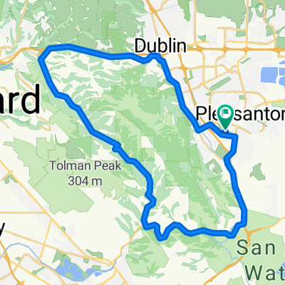
Overview
About this route
- -:--
- Duration
- 173.6 km
- Distance
- 2,200 m
- Ascent
- 2,199 m
- Descent
- ---
- Avg. speed
- ---
- Max. altitude
created this 14 years ago
Route quality
Waytypes & surfaces along the route
Waytypes
Road
92 km
(53 %)
Cycleway
5.2 km
(3 %)
Surfaces
Paved
36.4 km
(21 %)
Asphalt
36.4 km
(21 %)
Undefined
137.1 km
(79 %)
Route highlights
Points of interest along the route
Point of interest after 19.3 km
Grocery shopping center: best stock-up location before Mines Rd
Point of interest after 24.8 km
7-Eleven Gas Station - stock up here before Altamont/Patterson
Point of interest after 68.8 km
CDF Station: back-up solution for water if The Junction is closed.
Point of interest after 69 km
The Junction Cafe: only food/drink spot between Livermore and Mt. Hamilton summit.
Point of interest after 98.6 km
Water, soda and snack vending machines in Lick Observatory back entrance
Point of interest after 132.1 km
7-Eleven store: stock up here before Sierra Rd.
Point of interest after 149.4 km
Park bathroom and water fountain available if you need an intermediate stop before Calaveras Rd
Continue with Bikemap
Use, edit, or download this cycling route
You would like to ride DMD South Prep or customize it for your own trip? Here is what you can do with this Bikemap route:
Free features
- Save this route as favorite or in collections
- Copy & plan your own version of this route
- Split it into stages to create a multi-day tour
- Sync your route with Garmin or Wahoo
Premium features
Free trial for 3 days, or one-time payment. More about Bikemap Premium.
- Navigate this route on iOS & Android
- Export a GPX / KML file of this route
- Create your custom printout (try it for free)
- Download this route for offline navigation
Discover more Premium features.
Get Bikemap PremiumFrom our community
Other popular routes starting in Pleasanton
- Palomares
- Cracking ride in Pleasanton
- 38.6 km
- 241 m
- 240 m
- Pleasanton, California, United States
- Morgan Territory and Vasco
- 114 km
- 950 m
- 950 m
- Pleasanton, California, United States
- pleasanton to concord
- 62.6 km
- 664 m
- 740 m
- Pleasanton, California, United States
- 60 Vintage Cir, Pleasanton to 60 Vintage Cir, Pleasanton
- 22.7 km
- 67 m
- 69 m
- Pleasanton, California, United States
- Pleasanton Ridge Climb
- 10.7 km
- 470 m
- 232 m
- Pleasanton, California, United States
- Shadow Cliffs-Mines Out and Back
- 63.5 km
- 586 m
- 579 m
- Pleasanton, California, United States
- High-speed route in Pleasanton
- 68.3 km
- 431 m
- 438 m
- Pleasanton, California, United States
Open it in the app


