

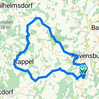
RV_Ailinger Kapelle_Eriskirch_RV
A cycling route starting in Ravensburg, Baden-Wurttemberg, Germany.
Overview
About this route
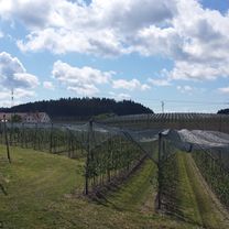
Schöne Rennragtour zu der Kapelle oberhalb von Ailingen. Ein kurzes Stück Weg um die Kapelle ist nicht befestigt.
- -:--
- Duration
- 58.5 km
- Distance
- 287 m
- Ascent
- 286 m
- Descent
- ---
- Avg. speed
- ---
- Max. altitude

Route quality
Waytypes & surfaces along the route
Waytypes
Quiet road
26.6 km
(45 %)
Road
8.6 km
(15 %)
Surfaces
Paved
46.9 km
(80 %)
Unpaved
4.2 km
(7 %)
Asphalt
45.8 km
(78 %)
Gravel
3.4 km
(6 %)
Continue with Bikemap
Use, edit, or download this cycling route
You would like to ride RV_Ailinger Kapelle_Eriskirch_RV or customize it for your own trip? Here is what you can do with this Bikemap route:
Free features
- Save this route as favorite or in collections
- Copy & plan your own version of this route
- Sync your route with Garmin or Wahoo
Premium features
Free trial for 3 days, or one-time payment. More about Bikemap Premium.
- Navigate this route on iOS & Android
- Export a GPX / KML file of this route
- Create your custom printout (try it for free)
- Download this route for offline navigation
Discover more Premium features.
Get Bikemap PremiumFrom our community
Other popular routes starting in Ravensburg
 Von Ravensburg nach Konstanz
- Distance
- 50.2 km
- Ascent
- 356 m
- Descent
- 389 m
- Location
- Ravensburg, Baden-Wurttemberg, Germany
 RV_GehrenbergTurm_RV
- Distance
- 62.8 km
- Ascent
- 462 m
- Descent
- 464 m
- Location
- Ravensburg, Baden-Wurttemberg, Germany
 Von Ravensburg nach Meersburg
- Distance
- 29.6 km
- Ascent
- 264 m
- Descent
- 288 m
- Location
- Ravensburg, Baden-Wurttemberg, Germany
 RV_Ailinger Kapelle_Eriskirch_RV
- Distance
- 58.5 km
- Ascent
- 287 m
- Descent
- 286 m
- Location
- Ravensburg, Baden-Wurttemberg, Germany
 Tobeltour
- Distance
- 49.3 km
- Ascent
- 629 m
- Descent
- 616 m
- Location
- Ravensburg, Baden-Wurttemberg, Germany
 20110507_RV_Deggenhausen_Illmensee_RV
- Distance
- 68.8 km
- Ascent
- 437 m
- Descent
- 436 m
- Location
- Ravensburg, Baden-Wurttemberg, Germany
 Ravensburg - Obereisenbach - Ettenkirchen - Runde
- Distance
- 40.6 km
- Ascent
- 470 m
- Descent
- 476 m
- Location
- Ravensburg, Baden-Wurttemberg, Germany
 Einfache Fahrt Ravensburg im Schußental
- Distance
- 25.1 km
- Ascent
- 652 m
- Descent
- 652 m
- Location
- Ravensburg, Baden-Wurttemberg, Germany
Open it in the app