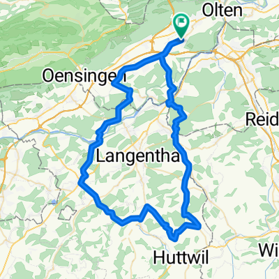
Schwarzwald Anfahrt II
A cycling route starting in Hägendorf, Canton of Solothurn, Switzerland.
Overview
About this route
Schwarzwald Anfahrt
Â
Hägendorf - Wangen bei Olten - Olten Obergösgen - Niedergösgen - Niedererlinsbach - Rombach - Kirchberg - Biberstein - Auenstein - Veltheim - Brugg - Lauffohr - Siggenthal Station - Döttingen - Klingnau - Koblenz - Grenzübertritt - Tiengen
- -:--
- Duration
- 63.8 km
- Distance
- 314 m
- Ascent
- 401 m
- Descent
- ---
- Avg. speed
- ---
- Avg. speed
Route quality
Waytypes & surfaces along the route
Waytypes
Busy road
34.6 km
(54 %)
Road
18.2 km
(29 %)
Surfaces
Paved
38.5 km
(60 %)
Asphalt
37.4 km
(59 %)
Paved (undefined)
0.9 km
(1 %)
Continue with Bikemap
Use, edit, or download this cycling route
You would like to ride Schwarzwald Anfahrt II or customize it for your own trip? Here is what you can do with this Bikemap route:
Free features
- Save this route as favorite or in collections
- Copy & plan your own version of this route
- Sync your route with Garmin or Wahoo
Premium features
Free trial for 3 days, or one-time payment. More about Bikemap Premium.
- Navigate this route on iOS & Android
- Export a GPX / KML file of this route
- Create your custom printout (try it for free)
- Download this route for offline navigation
Discover more Premium features.
Get Bikemap PremiumFrom our community
Other popular routes starting in Hägendorf
- Nellenacker 45, Hägendorf nach Bühlweg 1, Hägendorf
- Distance
- 30.6 km
- Ascent
- 217 m
- Descent
- 201 m
- Location
- Hägendorf, Canton of Solothurn, Switzerland
- Chasseral Mt.Crosin Schelten Chilchzimmer
- Distance
- 208.9 km
- Ascent
- 2,754 m
- Descent
- 2,754 m
- Location
- Hägendorf, Canton of Solothurn, Switzerland
- Hägendorf-Solothurn
- Distance
- 41.1 km
- Ascent
- 257 m
- Descent
- 251 m
- Location
- Hägendorf, Canton of Solothurn, Switzerland
- oberer Hauenstein Baselbiet Benkerjoch
- Distance
- 104.5 km
- Ascent
- 1,376 m
- Descent
- 1,376 m
- Location
- Hägendorf, Canton of Solothurn, Switzerland
- Hägendorf Staffelegg Scherz Hägendorf
- Distance
- 91 km
- Ascent
- 864 m
- Descent
- 864 m
- Location
- Hägendorf, Canton of Solothurn, Switzerland
- Letzte Etappe Bodensee Rundfahrt
- Distance
- 45.6 km
- Ascent
- 185 m
- Descent
- 110 m
- Location
- Hägendorf, Canton of Solothurn, Switzerland
- Lieblingsroute
- Distance
- 23.9 km
- Ascent
- 602 m
- Descent
- 602 m
- Location
- Hägendorf, Canton of Solothurn, Switzerland
- Langenbruckstrasse 17, Hägendorf nach Langenbruckstrasse 10, Hägendorf
- Distance
- 24.7 km
- Ascent
- 589 m
- Descent
- 585 m
- Location
- Hägendorf, Canton of Solothurn, Switzerland
Open it in the app