

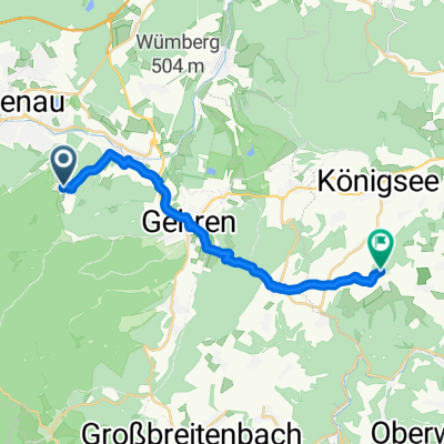
Rudolf-Breitscheid-Straße Ilmenau
A cycling route starting in Langewiesen, Thuringia, Germany.
Overview
About this route
- 1 h 39 min
- Duration
- 23.9 km
- Distance
- 490 m
- Ascent
- 492 m
- Descent
- 14.5 km/h
- Avg. speed
- ---
- Max. altitude
Route photos


Route quality
Waytypes & surfaces along the route
Waytypes
Track
17.2 km
(72 %)
Quiet road
3.1 km
(13 %)
Surfaces
Paved
4.7 km
(20 %)
Unpaved
18.5 km
(78 %)
Loose gravel
9.4 km
(39 %)
Asphalt
4.6 km
(19 %)
Continue with Bikemap
Use, edit, or download this cycling route
You would like to ride Rudolf-Breitscheid-Straße Ilmenau or customize it for your own trip? Here is what you can do with this Bikemap route:
Free features
- Save this route as favorite or in collections
- Copy & plan your own version of this route
- Sync your route with Garmin or Wahoo
Premium features
Free trial for 3 days, or one-time payment. More about Bikemap Premium.
- Navigate this route on iOS & Android
- Export a GPX / KML file of this route
- Create your custom printout (try it for free)
- Download this route for offline navigation
Discover more Premium features.
Get Bikemap PremiumFrom our community
Other popular routes starting in Langewiesen
 20150522_170629.gpx
- Distance
- 101.8 km
- Ascent
- 1,210 m
- Descent
- 1,103 m
- Location
- Langewiesen, Thuringia, Germany
 Ilmenau -Hohewarte - Ilmenau
- Distance
- 121 km
- Ascent
- 868 m
- Descent
- 781 m
- Location
- Langewiesen, Thuringia, Germany
 Barigauer Turm
- Distance
- 15.6 km
- Ascent
- 335 m
- Descent
- 318 m
- Location
- Langewiesen, Thuringia, Germany
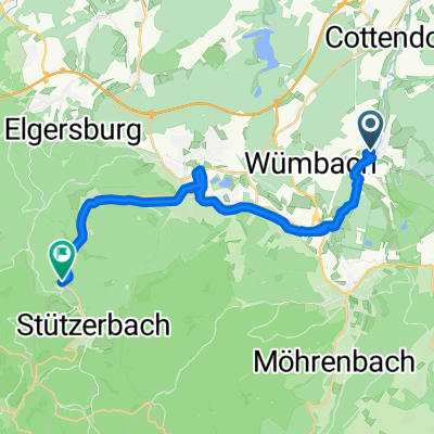 Wümbacher Straße nach Schmücker Straße
- Distance
- 21.9 km
- Ascent
- 238 m
- Descent
- 115 m
- Location
- Langewiesen, Thuringia, Germany
 Rudolf-Breitscheid-Straße Ilmenau
- Distance
- 23.9 km
- Ascent
- 490 m
- Descent
- 492 m
- Location
- Langewiesen, Thuringia, Germany
 suhl euerdorf
- Distance
- 128.1 km
- Ascent
- 849 m
- Descent
- 1,111 m
- Location
- Langewiesen, Thuringia, Germany
 Ilmenau - Vessertal
- Distance
- 70.9 km
- Ascent
- 956 m
- Descent
- 953 m
- Location
- Langewiesen, Thuringia, Germany
 Stadtilm - Paulinzella
- Distance
- 47.8 km
- Ascent
- 389 m
- Descent
- 389 m
- Location
- Langewiesen, Thuringia, Germany
Open it in the app