
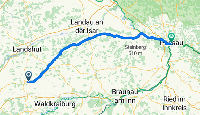
Tag 3
A cycling route starting in Aham, Bavaria, Germany.
Overview
About this route
- -:--
- Duration
- 120.9 km
- Distance
- 0 m
- Ascent
- 0 m
- Descent
- ---
- Avg. speed
- ---
- Max. altitude

Route quality
Waytypes & surfaces along the route
Waytypes
Quiet road
37.5 km
(31 %)
Path
36.3 km
(30 %)
Surfaces
Paved
91.9 km
(76 %)
Unpaved
4.8 km
(4 %)
Asphalt
85.9 km
(71 %)
Paved (undefined)
6 km
(5 %)
Continue with Bikemap
Use, edit, or download this cycling route
You would like to ride Tag 3 or customize it for your own trip? Here is what you can do with this Bikemap route:
Free features
- Save this route as favorite or in collections
- Copy & plan your own version of this route
- Split it into stages to create a multi-day tour
- Sync your route with Garmin or Wahoo
Premium features
Free trial for 3 days, or one-time payment. More about Bikemap Premium.
- Navigate this route on iOS & Android
- Export a GPX / KML file of this route
- Create your custom printout (try it for free)
- Download this route for offline navigation
Discover more Premium features.
Get Bikemap PremiumFrom our community
Other popular routes starting in Aham
 Vikram - Walchsee
- Distance
- 111.2 km
- Ascent
- 546 m
- Descent
- 391 m
- Location
- Aham, Bavaria, Germany
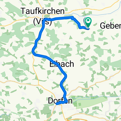
 Geislbach 17, Taufkirchen (Vils) nach Seligenthaler Straße 7, Landshut
- Distance
- 24.2 km
- Ascent
- 352 m
- Descent
- 426 m
- Location
- Aham, Bavaria, Germany
 Dorfen
- Distance
- 31.5 km
- Ascent
- 222 m
- Descent
- 216 m
- Location
- Aham, Bavaria, Germany
 Taufkirchen - Rosenheim
- Distance
- 75.9 km
- Ascent
- 380 m
- Descent
- 359 m
- Location
- Aham, Bavaria, Germany
 Rundfahrt Taufkirchen
- Distance
- 249.3 km
- Ascent
- 219 m
- Descent
- 222 m
- Location
- Aham, Bavaria, Germany
 Tag 3
Tag 3- Distance
- 120.9 km
- Ascent
- 0 m
- Descent
- 0 m
- Location
- Aham, Bavaria, Germany
 B388, Taufkirchen (Vils) nach Schützenstraße 16B, Vilsbiburg
- Distance
- 22.1 km
- Ascent
- 138 m
- Descent
- 153 m
- Location
- Aham, Bavaria, Germany
 2013 Moosen - Holzham(Vilstal RW- Bockerlbahn RW)
- Distance
- 72.3 km
- Ascent
- 184 m
- Descent
- 177 m
- Location
- Aham, Bavaria, Germany
Open it in the app