

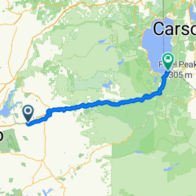
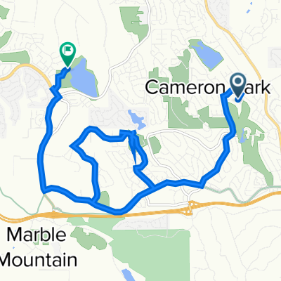
Cameron Park to Bijou
A cycling route starting in Cameron Park, California, United States.
Overview
About this route
- -:--
- Duration
- 123.3 km
- Distance
- 2,187 m
- Ascent
- 689 m
- Descent
- ---
- Avg. speed
- ---
- Max. altitude

Route quality
Waytypes & surfaces along the route
Waytypes
Cycleway
58 km
(47 %)
Quiet road
32.1 km
(26 %)
Surfaces
Paved
85.1 km
(69 %)
Asphalt
75.2 km
(61 %)
Paved (undefined)
9.9 km
(8 %)
Undefined
38.2 km
(31 %)
Continue with Bikemap
Use, edit, or download this cycling route
You would like to ride Cameron Park to Bijou or customize it for your own trip? Here is what you can do with this Bikemap route:
Free features
- Save this route as favorite or in collections
- Copy & plan your own version of this route
- Split it into stages to create a multi-day tour
- Sync your route with Garmin or Wahoo
Premium features
Free trial for 3 days, or one-time payment. More about Bikemap Premium.
- Navigate this route on iOS & Android
- Export a GPX / KML file of this route
- Create your custom printout (try it for free)
- Download this route for offline navigation
Discover more Premium features.
Get Bikemap PremiumFrom our community
Other popular routes starting in Cameron Park
 Cameron Park to Bijou
- Distance
- 123.3 km
- Ascent
- 2,187 m
- Descent
- 689 m
- Location
- Cameron Park, California, United States
 Bass Lake Ride
- Distance
- 16 km
- Ascent
- 254 m
- Descent
- 245 m
- Location
- Cameron Park, California, United States
 Historic Lincoln Highway 8K Run/Jog/Walk
- Distance
- 7.8 km
- Ascent
- 176 m
- Descent
- 177 m
- Location
- Cameron Park, California, United States
 Relaxed route in Cameron Park
- Distance
- 6.6 km
- Ascent
- 100 m
- Descent
- 104 m
- Location
- Cameron Park, California, United States
 Relaxed route in El Dorado Hills
- Distance
- 4.8 km
- Ascent
- 82 m
- Descent
- 75 m
- Location
- Cameron Park, California, United States
 Home to Placerville
- Distance
- 33.5 km
- Ascent
- 783 m
- Descent
- 449 m
- Location
- Cameron Park, California, United States
 e bike route
- Distance
- 11 km
- Ascent
- 146 m
- Descent
- 145 m
- Location
- Cameron Park, California, United States
 Forni Rd to Serrano
- Distance
- 31.6 km
- Ascent
- 451 m
- Descent
- 244 m
- Location
- Cameron Park, California, United States
Open it in the app