

2005
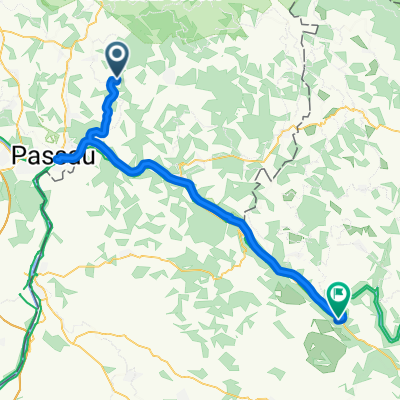
2005 - Passau - Györ - 1. Tag - Passau - Ottensheim
A cycling route starting in Thyrnau, Bavaria, Germany.
Overview
About this route
- -:--
- Duration
- 79.7 km
- Distance
- 533 m
- Ascent
- 556 m
- Descent
- ---
- Avg. speed
- 515 m
- Max. altitude

Part of
2005
8 stages
Route quality
Waytypes & surfaces along the route
Waytypes
Quiet road
23.1 km
(29 %)
Track
15.9 km
(20 %)
Surfaces
Paved
51 km
(64 %)
Unpaved
10.4 km
(13 %)
Asphalt
50.2 km
(63 %)
Ground
7.2 km
(9 %)
Continue with Bikemap
Use, edit, or download this cycling route
You would like to ride 2005 - Passau - Györ - 1. Tag - Passau - Ottensheim or customize it for your own trip? Here is what you can do with this Bikemap route:
Free features
- Save this route as favorite or in collections
- Copy & plan your own version of this route
- Sync your route with Garmin or Wahoo
Premium features
Free trial for 3 days, or one-time payment. More about Bikemap Premium.
- Navigate this route on iOS & Android
- Export a GPX / KML file of this route
- Create your custom printout (try it for free)
- Download this route for offline navigation
Discover more Premium features.
Get Bikemap PremiumFrom our community
Other popular routes starting in Thyrnau
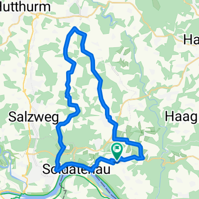
 Steco 2
- Distance
- 50.3 km
- Ascent
- 842 m
- Descent
- 814 m
- Location
- Thyrnau, Bavaria, Germany
 Rowerem wzdłuż Dunaju - 14.07.2013 r.
- Distance
- 55.9 km
- Ascent
- 477 m
- Descent
- 643 m
- Location
- Thyrnau, Bavaria, Germany
 Rowerem wzdłuż Dunaju - 14.07.2013 r.
- Distance
- 55.9 km
- Ascent
- 621 m
- Descent
- 787 m
- Location
- Thyrnau, Bavaria, Germany
 Kellberg - Buechlberg - Runde CLONED FROM ROUTE 167495
- Distance
- 27.2 km
- Ascent
- 503 m
- Descent
- 503 m
- Location
- Thyrnau, Bavaria, Germany
 🚴E*MTB🇩🇪 Freudensee – Bachweg Runde von Thyrnau
- Distance
- 31.9 km
- Ascent
- 665 m
- Descent
- 660 m
- Location
- Thyrnau, Bavaria, Germany
 Kellberg - Klafferstrass-Kellberg
- Distance
- 87.1 km
- Ascent
- 1,894 m
- Descent
- 1,893 m
- Location
- Thyrnau, Bavaria, Germany
 Obernzell-Oberachleiten-Kneiding- Schartenberg -Ingling - Passau - Kellber
- Distance
- 55.2 km
- Ascent
- 1,273 m
- Descent
- 1,261 m
- Location
- Thyrnau, Bavaria, Germany
 2005 - Passau - Györ - Übersicht
- Distance
- 516.7 km
- Ascent
- 153 m
- Descent
- 371 m
- Location
- Thyrnau, Bavaria, Germany
Open it in the app