

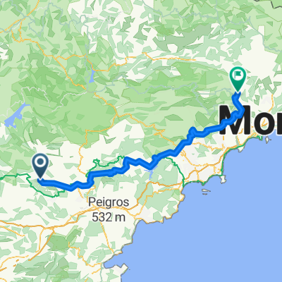
D557, Villecroze nach 126–128 Chemin de Camp Fournier, Tourtour
A cycling route starting in Villecroze, Provence-Alpes-Côte d'Azur Region, France.
Overview
About this route
- 17 min
- Duration
- 4.4 km
- Distance
- 178 m
- Ascent
- 12 m
- Descent
- 15.4 km/h
- Avg. speed
- ---
- Max. altitude
Route quality
Waytypes & surfaces along the route
Waytypes
Road
3.6 km
(82 %)
Quiet road
0.8 km
(18 %)
Surfaces
Paved
0.4 km
(9 %)
Asphalt
0.4 km
(9 %)
Undefined
4 km
(91 %)
Continue with Bikemap
Use, edit, or download this cycling route
You would like to ride D557, Villecroze nach 126–128 Chemin de Camp Fournier, Tourtour or customize it for your own trip? Here is what you can do with this Bikemap route:
Free features
- Save this route as favorite or in collections
- Copy & plan your own version of this route
- Sync your route with Garmin or Wahoo
Premium features
Free trial for 3 days, or one-time payment. More about Bikemap Premium.
- Navigate this route on iOS & Android
- Export a GPX / KML file of this route
- Create your custom printout (try it for free)
- Download this route for offline navigation
Discover more Premium features.
Get Bikemap PremiumFrom our community
Other popular routes starting in Villecroze
 Provence_Cotignac
- Distance
- 46.2 km
- Ascent
- 660 m
- Descent
- 660 m
- Location
- Villecroze, Provence-Alpes-Côte d'Azur Region, France
 TourTour - Entrecasteaux
- Distance
- 14.1 km
- Ascent
- 77 m
- Descent
- 524 m
- Location
- Villecroze, Provence-Alpes-Côte d'Azur Region, France
 Route 11
- Distance
- 132.8 km
- Ascent
- 1,635 m
- Descent
- 1,548 m
- Location
- Villecroze, Provence-Alpes-Côte d'Azur Region, France
 23) Villecroze - Saint Raphaël
- Distance
- 72 km
- Ascent
- 299 m
- Descent
- 545 m
- Location
- Villecroze, Provence-Alpes-Côte d'Azur Region, France
 Le balcon du haut Var 2007
- Distance
- 57.7 km
- Ascent
- 869 m
- Descent
- 852 m
- Location
- Villecroze, Provence-Alpes-Côte d'Azur Region, France
2713®
Villecroze Cycling- Distance
- 126.2 km
- Ascent
- 1,451 m
- Descent
- 1,603 m
- Location
- Villecroze, Provence-Alpes-Côte d'Azur Region, France
 Tour Tour -road circuite with tour of Grimaldi tower
- Distance
- 48.2 km
- Ascent
- 704 m
- Descent
- 703 m
- Location
- Villecroze, Provence-Alpes-Côte d'Azur Region, France
 Etapa 087B (Villecroze - Dauphin)
- Distance
- 142.5 km
- Ascent
- 1,537 m
- Descent
- 1,431 m
- Location
- Villecroze, Provence-Alpes-Côte d'Azur Region, France
Open it in the app