

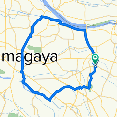
Sakitama, Gyoda to 1086, Wada, Gyoda
A cycling route starting in Gyōda, Saitama, Japan.
Overview
About this route
- 1 h 24 min
- Duration
- 19.3 km
- Distance
- 19 m
- Ascent
- 17 m
- Descent
- 13.8 km/h
- Avg. speed
- ---
- Max. altitude
Route quality
Waytypes & surfaces along the route
Waytypes
Cycleway
6.7 km
(35 %)
Quiet road
3.7 km
(19 %)
Continue with Bikemap
Use, edit, or download this cycling route
You would like to ride Sakitama, Gyoda to 1086, Wada, Gyoda or customize it for your own trip? Here is what you can do with this Bikemap route:
Free features
- Save this route as favorite or in collections
- Copy & plan your own version of this route
- Sync your route with Garmin or Wahoo
Premium features
Free trial for 3 days, or one-time payment. More about Bikemap Premium.
- Navigate this route on iOS & Android
- Export a GPX / KML file of this route
- Create your custom printout (try it for free)
- Download this route for offline navigation
Discover more Premium features.
Get Bikemap PremiumFrom our community
Other popular routes starting in Gyōda
 Sakitama, Gyoda to 1086, Wada, Gyoda
- Distance
- 19.3 km
- Ascent
- 19 m
- Descent
- 17 m
- Location
- Gyōda, Saitama, Japan
 映画「のぼうの城」舞台めぐり
- Distance
- 4.9 km
- Ascent
- 11 m
- Descent
- 10 m
- Location
- Gyōda, Saitama, Japan
 行田市 to 3丁目, さいたま市
- Distance
- 46.3 km
- Ascent
- 15 m
- Descent
- 42 m
- Location
- Gyōda, Saitama, Japan
 64 「のぼうの城」の歴史と利根の自然を満喫するルート
- Distance
- 25.3 km
- Ascent
- 64 m
- Descent
- 65 m
- Location
- Gyōda, Saitama, Japan
 De 2-chōme 25, Gyoda a 2-chōme 25, Gyoda
- Distance
- 78.8 km
- Ascent
- 206 m
- Descent
- 204 m
- Location
- Gyōda, Saitama, Japan
 Kounossu
- Distance
- 38.6 km
- Ascent
- 308 m
- Descent
- 285 m
- Location
- Gyōda, Saitama, Japan
 Desafio 100k Plano B
- Distance
- 51.8 km
- Ascent
- 141 m
- Descent
- 155 m
- Location
- Gyōda, Saitama, Japan
 De 2-chōme 25, Gyoda a Gyoda
- Distance
- 32 km
- Ascent
- 220 m
- Descent
- 220 m
- Location
- Gyōda, Saitama, Japan
Open it in the app