

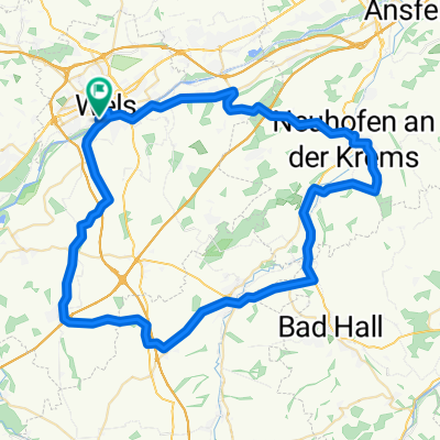
Wels - Steinhaus - Sipbachzell - Weißkirchen - Wels Optimal
A cycling route starting in Thalheim bei Wels, Upper Austria, Austria.
Overview
About this route
- 1 h 42 min
- Duration
- 34.9 km
- Distance
- 301 m
- Ascent
- 305 m
- Descent
- 20.5 km/h
- Avg. speed
- ---
- Max. altitude

Route quality
Waytypes & surfaces along the route
Waytypes
Quiet road
23.4 km
(67 %)
Access road
4.9 km
(14 %)
Surfaces
Paved
5.2 km
(15 %)
Unpaved
2.1 km
(6 %)
Asphalt
5.2 km
(15 %)
Gravel
1 km
(3 %)
Continue with Bikemap
Use, edit, or download this cycling route
You would like to ride Wels - Steinhaus - Sipbachzell - Weißkirchen - Wels Optimal or customize it for your own trip? Here is what you can do with this Bikemap route:
Free features
- Save this route as favorite or in collections
- Copy & plan your own version of this route
- Sync your route with Garmin or Wahoo
Premium features
Free trial for 3 days, or one-time payment. More about Bikemap Premium.
- Navigate this route on iOS & Android
- Export a GPX / KML file of this route
- Create your custom printout (try it for free)
- Download this route for offline navigation
Discover more Premium features.
Get Bikemap PremiumFrom our community
Other popular routes starting in Thalheim bei Wels
 Lindenstraße 24, Wels nach Steinbergstraße 5, Marchtrenk
- Distance
- 12.6 km
- Ascent
- 3 m
- Descent
- 67 m
- Location
- Thalheim bei Wels, Upper Austria, Austria
 Kleine Fernreither Runde
- Distance
- 26.5 km
- Ascent
- 81 m
- Descent
- 84 m
- Location
- Thalheim bei Wels, Upper Austria, Austria
 Wels - Riethal - Pennewang - Wels
- Distance
- 41.4 km
- Ascent
- 182 m
- Descent
- 184 m
- Location
- Thalheim bei Wels, Upper Austria, Austria
 WelsWest-Scharten Roitham-WelsWest
- Distance
- 35.1 km
- Ascent
- 421 m
- Descent
- 424 m
- Location
- Thalheim bei Wels, Upper Austria, Austria
 WÖS CALLING
- Distance
- 239.3 km
- Ascent
- 124 m
- Descent
- 254 m
- Location
- Thalheim bei Wels, Upper Austria, Austria
 Wels Eberhartszell Kematen Allhaming
- Distance
- 68.6 km
- Ascent
- 493 m
- Descent
- 494 m
- Location
- Thalheim bei Wels, Upper Austria, Austria
 Sipbachzell-Eggendorf Wasserschloss
- Distance
- 43.5 km
- Ascent
- 291 m
- Descent
- 291 m
- Location
- Thalheim bei Wels, Upper Austria, Austria
 Wels nach Linz über Traun
- Distance
- 33.4 km
- Ascent
- 123 m
- Descent
- 177 m
- Location
- Thalheim bei Wels, Upper Austria, Austria
Open it in the app