Mortirolo-Gavia Tour
A cycling route starting in Valdisotto, Lombardy, Italy.
Overview
About this route
- -:--
- Duration
- 114.2 km
- Distance
- 3,247 m
- Ascent
- 3,142 m
- Descent
- ---
- Avg. speed
- ---
- Avg. speed
Continue with Bikemap
Use, edit, or download this cycling route
You would like to ride Mortirolo-Gavia Tour or customize it for your own trip? Here is what you can do with this Bikemap route:
Free features
- Save this route as favorite or in collections
- Copy & plan your own version of this route
- Sync your route with Garmin or Wahoo
Premium features
Free trial for 3 days, or one-time payment. More about Bikemap Premium.
- Navigate this route on iOS & Android
- Export a GPX / KML file of this route
- Create your custom printout (try it for free)
- Download this route for offline navigation
Discover more Premium features.
Get Bikemap PremiumFrom our community
Other popular routes starting in Valdisotto
- HotelCepina Santa Caterina
- Distance
- 43 km
- Ascent
- 1,073 m
- Descent
- 1,073 m
- Location
- Valdisotto, Lombardy, Italy
- Hotel Cepina Val di Rezzalo
- Distance
- 53.5 km
- Ascent
- 1,568 m
- Descent
- 1,568 m
- Location
- Valdisotto, Lombardy, Italy
- Mortirolo,Gavia
- Distance
- 109.7 km
- Ascent
- 3,523 m
- Descent
- 3,529 m
- Location
- Valdisotto, Lombardy, Italy
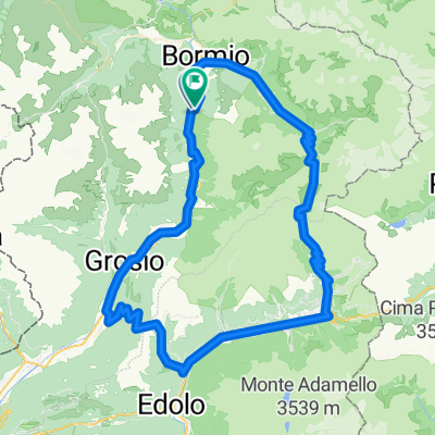
- Cepina Alpy 2013 (1.den)
- Distance
- 81.1 km
- Ascent
- 1,403 m
- Descent
- 1,403 m
- Location
- Valdisotto, Lombardy, Italy
- Val Viola
- Distance
- 71.1 km
- Ascent
- 1,368 m
- Descent
- 1,368 m
- Location
- Valdisotto, Lombardy, Italy
- Bosco Piano
- Distance
- 38.6 km
- Ascent
- 1,048 m
- Descent
- 1,048 m
- Location
- Valdisotto, Lombardy, Italy
- Pista ciclabile dell'alu
- Distance
- 10.4 km
- Ascent
- 114 m
- Descent
- 114 m
- Location
- Valdisotto, Lombardy, Italy
- Cepina Alpy 2013 (3.den)
- Distance
- 60.8 km
- Ascent
- 1,587 m
- Descent
- 1,587 m
- Location
- Valdisotto, Lombardy, Italy
Open it in the app