
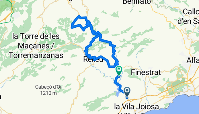
Ruta 19A : Orxeta-Sella/Pto Tudons/Relleu/Orxeta
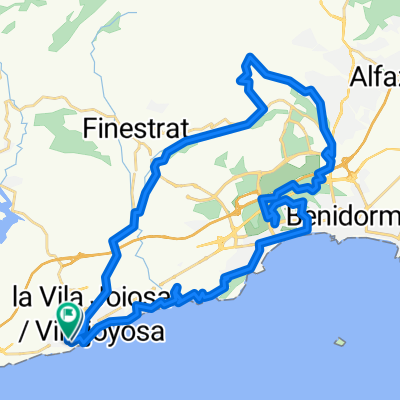
A cycling route starting in Villajoyosa, Valencia, Spain.
Overview
About this route
La Ermita (98m)
Orxeta (178m)...................05
Sella (402m)......................12
>> Pto Tudons (1024m).....24
Safari Aitana.......................27
CV-770 (829m)..................33
CV-775 ..............................35
Relleu (470m).....................45
CV-770................................51
Orxeta (187m).................55 km
- -:--
- Duration
- 54.7 km
- Distance
- 968 m
- Ascent
- 879 m
- Descent
- ---
- Avg. speed
- 1,026 m
- Max. altitude

Route quality
Waytypes & surfaces along the route
Waytypes
Busy road
50.7 km
(93 %)
Quiet road
2.7 km
(5 %)
Surfaces
Paved
5.7 km
(10 %)
Asphalt
5.6 km
(10 %)
Concrete
0.1 km
(<1 %)
Undefined
49 km
(90 %)
Continue with Bikemap
Use, edit, or download this cycling route
You would like to ride Ruta 19A : Orxeta-Sella/Pto Tudons/Relleu/Orxeta or customize it for your own trip? Here is what you can do with this Bikemap route:
Free features
- Save this route as favorite or in collections
- Copy & plan your own version of this route
- Sync your route with Garmin or Wahoo
Premium features
Free trial for 3 days, or one-time payment. More about Bikemap Premium.
- Navigate this route on iOS & Android
- Export a GPX / KML file of this route
- Create your custom printout (try it for free)
- Download this route for offline navigation
Discover more Premium features.
Get Bikemap PremiumFrom our community
Other popular routes starting in Villajoyosa
 Mar y montaña
- Distance
- 70.7 km
- Ascent
- 1,407 m
- Descent
- 1,404 m
- Location
- Villajoyosa, Valencia, Spain
 Villajoyosa - Montduver
- Distance
- 246.6 km
- Ascent
- 3,834 m
- Descent
- 3,052 m
- Location
- Villajoyosa, Valencia, Spain
 villajoyossa_alicante.gpx
- Distance
- 35.9 km
- Ascent
- 305 m
- Descent
- 316 m
- Location
- Villajoyosa, Valencia, Spain
 Finestrat Åse 190920
- Distance
- 42.3 km
- Ascent
- 832 m
- Descent
- 825 m
- Location
- Villajoyosa, Valencia, Spain
 RUTA 27: Orxeta-Pto Tudons-Castells-Parcent
- Distance
- 78.4 km
- Ascent
- 1,269 m
- Descent
- 1,099 m
- Location
- Villajoyosa, Valencia, Spain
 La Vila - La Torre - Carrasqueta - Penaguila - La Vila
- Distance
- 113.9 km
- Ascent
- 1,804 m
- Descent
- 1,808 m
- Location
- Villajoyosa, Valencia, Spain
 30/03/2014 12:34 p.m.
- Distance
- 44.4 km
- Ascent
- 653 m
- Descent
- 649 m
- Location
- Villajoyosa, Valencia, Spain
 Embalse de Amadono - Relleu
- Distance
- 40.7 km
- Ascent
- 572 m
- Descent
- 572 m
- Location
- Villajoyosa, Valencia, Spain
Open it in the app