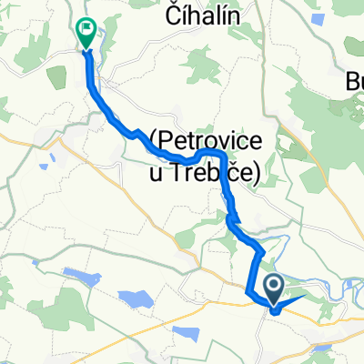
koniklece
A cycling route starting in Stařeč, Kraj Vysočina, Czechia.
Overview
About this route
Čím více zde napíšete informací, tím více bude užitečnější pro ostatním uživatele.* Průběh trasy.* Co je zvláštní na této trase?* Proč doporučit tuto trasu?* Co se Vám zde nejvíce líbilo?* Atd.
- -:--
- Duration
- 14.6 km
- Distance
- 138 m
- Ascent
- 159 m
- Descent
- ---
- Avg. speed
- ---
- Avg. speed
Route quality
Waytypes & surfaces along the route
Waytypes
Track
5 km
(34 %)
Busy road
4.8 km
(33 %)
Surfaces
Paved
3.1 km
(21 %)
Unpaved
4.2 km
(29 %)
Asphalt
3.1 km
(21 %)
Unpaved (undefined)
2.9 km
(20 %)
Continue with Bikemap
Use, edit, or download this cycling route
You would like to ride koniklece or customize it for your own trip? Here is what you can do with this Bikemap route:
Free features
- Save this route as favorite or in collections
- Copy & plan your own version of this route
- Sync your route with Garmin or Wahoo
Premium features
Free trial for 3 days, or one-time payment. More about Bikemap Premium.
- Navigate this route on iOS & Android
- Export a GPX / KML file of this route
- Create your custom printout (try it for free)
- Download this route for offline navigation
Discover more Premium features.
Get Bikemap PremiumFrom our community
Other popular routes starting in Stařeč
- Řípov 49, Třebíč to Ve Bráně 47, Přibyslavice
- Distance
- 9.2 km
- Ascent
- 55 m
- Descent
- 105 m
- Location
- Stařeč, Kraj Vysočina, Czechia
- Krahulov - Želetava přes Mařenku
- Distance
- 41.8 km
- Ascent
- 456 m
- Descent
- 456 m
- Location
- Stařeč, Kraj Vysočina, Czechia
- Krahulov - Jihlava nádraží
- Distance
- 36.6 km
- Ascent
- 325 m
- Descent
- 307 m
- Location
- Stařeč, Kraj Vysočina, Czechia
- koniklece
- Distance
- 14.6 km
- Ascent
- 138 m
- Descent
- 159 m
- Location
- Stařeč, Kraj Vysočina, Czechia
- Třebíč - Bítov (rozhledna u Rumburaku) -Třebíč
- Distance
- 92.8 km
- Ascent
- 625 m
- Descent
- 612 m
- Location
- Stařeč, Kraj Vysočina, Czechia
- rudá stezka
- Distance
- 21.1 km
- Ascent
- 298 m
- Descent
- 286 m
- Location
- Stařeč, Kraj Vysočina, Czechia
- stařeč - želetava - babice - sádek - stařeč
- Distance
- 42.3 km
- Ascent
- 568 m
- Descent
- 564 m
- Location
- Stařeč, Kraj Vysočina, Czechia
- Sadek - Test
- Distance
- 11 km
- Ascent
- 138 m
- Descent
- 260 m
- Location
- Stařeč, Kraj Vysočina, Czechia
Open it in the app