

Overview
About this route
- -:--
- Duration
- 155.5 km
- Distance
- 1,911 m
- Ascent
- 1,680 m
- Descent
- ---
- Avg. speed
- 1,771 m
- Max. altitude

Part of
Montañas vacias
5 stages
Route quality
Waytypes & surfaces along the route
Waytypes
Road
45.1 km
(29 %)
Quiet road
15.6 km
(10 %)
Surfaces
Paved
63.8 km
(41 %)
Asphalt
63.8 km
(41 %)
Undefined
91.7 km
(59 %)
Route highlights
Points of interest along the route
Point of interest after 144 km
Ciudad encantada
Continue with Bikemap
Use, edit, or download this cycling route
You would like to ride MV3.1-jhl or customize it for your own trip? Here is what you can do with this Bikemap route:
Free features
- Save this route as favorite or in collections
- Copy & plan your own version of this route
- Split it into stages to create a multi-day tour
- Sync your route with Garmin or Wahoo
Premium features
Free trial for 3 days, or one-time payment. More about Bikemap Premium.
- Navigate this route on iOS & Android
- Export a GPX / KML file of this route
- Create your custom printout (try it for free)
- Download this route for offline navigation
Discover more Premium features.
Get Bikemap PremiumFrom our community
Other popular routes starting in Teruel
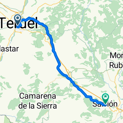 Day 1: Teruel - Sarrión
- Distance
- 44.4 km
- Ascent
- 559 m
- Descent
- 484 m
- Location
- Teruel, Aragon, Spain
 Montañas Vacías 1-5
- Distance
- 675 km
- Ascent
- 14,002 m
- Descent
- 14,002 m
- Location
- Teruel, Aragon, Spain
 El CID Teruel-Valencia
- Distance
- 215.7 km
- Ascent
- 2,606 m
- Descent
- 3,499 m
- Location
- Teruel, Aragon, Spain
 Teruel-Dernaque-Valdecuenca-Toril-Javalambre-Teruel
- Distance
- 195.1 km
- Ascent
- 2,119 m
- Descent
- 2,127 m
- Location
- Teruel, Aragon, Spain
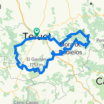
 MV3.1-jhl
- Distance
- 155.5 km
- Ascent
- 1,911 m
- Descent
- 1,680 m
- Location
- Teruel, Aragon, Spain
 Teruel: Montes Universales. (La Berrea)
- Distance
- 202.1 km
- Ascent
- 1,859 m
- Descent
- 1,858 m
- Location
- Teruel, Aragon, Spain
 Teruel-Sagunto
- Distance
- 149.5 km
- Ascent
- 379 m
- Descent
- 1,257 m
- Location
- Teruel, Aragon, Spain
 castelfabib>teruel
- Distance
- 276 km
- Ascent
- 6,300 m
- Descent
- 6,302 m
- Location
- Teruel, Aragon, Spain
Open it in the app