

*AMTB Diabelski most
A cycling route starting in Krzeszowice, Lesser Poland Voivodeship, Poland.
Overview
About this route
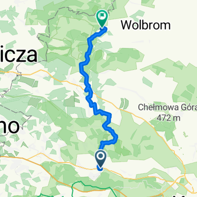
Start: Krzeszowice. Parking at the PKP station.
always following the blue bike trail
Bartłowa Góra
Furta Siedlecka
Diabelski Most
Brama Siedlecka
Łysa Góra
Finish: Krzeszowice
- -:--
- Duration
- 16.7 km
- Distance
- 320 m
- Ascent
- 321 m
- Descent
- ---
- Avg. speed
- ---
- Max. altitude

Route quality
Waytypes & surfaces along the route
Waytypes
Quiet road
5 km
(30 %)
Path
4.7 km
(28 %)
Surfaces
Paved
8.4 km
(50 %)
Unpaved
4.5 km
(27 %)
Asphalt
7.9 km
(47 %)
Gravel
2 km
(12 %)
Continue with Bikemap
Use, edit, or download this cycling route
You would like to ride *AMTB Diabelski most or customize it for your own trip? Here is what you can do with this Bikemap route:
Free features
- Save this route as favorite or in collections
- Copy & plan your own version of this route
- Sync your route with Garmin or Wahoo
Premium features
Free trial for 3 days, or one-time payment. More about Bikemap Premium.
- Navigate this route on iOS & Android
- Export a GPX / KML file of this route
- Create your custom printout (try it for free)
- Download this route for offline navigation
Discover more Premium features.
Get Bikemap PremiumFrom our community
Other popular routes starting in Krzeszowice
 Nielepickie skałki
- Distance
- 29.4 km
- Ascent
- 316 m
- Descent
- 319 m
- Location
- Krzeszowice, Lesser Poland Voivodeship, Poland
 Krzeszowice - Krakow
- Distance
- 30.7 km
- Ascent
- 322 m
- Descent
- 359 m
- Location
- Krzeszowice, Lesser Poland Voivodeship, Poland
 Nawojowa Góra - Kraków
- Distance
- 33.4 km
- Ascent
- 148 m
- Descent
- 198 m
- Location
- Krzeszowice, Lesser Poland Voivodeship, Poland
 Miękinia-Tenczyn
- Distance
- 25.6 km
- Ascent
- 627 m
- Descent
- 626 m
- Location
- Krzeszowice, Lesser Poland Voivodeship, Poland
 KRA Gorejące Szwedzkie Drogi
- Distance
- 27.9 km
- Ascent
- 334 m
- Descent
- 334 m
- Location
- Krzeszowice, Lesser Poland Voivodeship, Poland
 *AMTB Diabelski most
- Distance
- 16.7 km
- Ascent
- 320 m
- Descent
- 321 m
- Location
- Krzeszowice, Lesser Poland Voivodeship, Poland
 Krak z Krzesz
- Distance
- 35.1 km
- Ascent
- 173 m
- Descent
- 216 m
- Location
- Krzeszowice, Lesser Poland Voivodeship, Poland
 Jura 1-szy dzień
- Distance
- 43.6 km
- Ascent
- 434 m
- Descent
- 339 m
- Location
- Krzeszowice, Lesser Poland Voivodeship, Poland
Open it in the app