
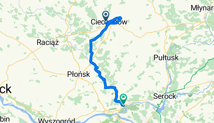
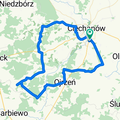
dolina Wkry (70 - 85 km)
A cycling route starting in Ciechanów, Masovian Voivodeship, Poland.
Overview
About this route
- -:--
- Duration
- 84.5 km
- Distance
- 112 m
- Ascent
- 160 m
- Descent
- ---
- Avg. speed
- ---
- Max. altitude

Route quality
Waytypes & surfaces along the route
Waytypes
Road
33.8 km
(40 %)
Quiet road
25.4 km
(30 %)
Surfaces
Paved
47.3 km
(56 %)
Unpaved
1.7 km
(2 %)
Asphalt
47.3 km
(56 %)
Unpaved (undefined)
1.7 km
(2 %)
Undefined
35.5 km
(42 %)
Continue with Bikemap
Use, edit, or download this cycling route
You would like to ride dolina Wkry (70 - 85 km) or customize it for your own trip? Here is what you can do with this Bikemap route:
Free features
- Save this route as favorite or in collections
- Copy & plan your own version of this route
- Split it into stages to create a multi-day tour
- Sync your route with Garmin or Wahoo
Premium features
Free trial for 3 days, or one-time payment. More about Bikemap Premium.
- Navigate this route on iOS & Android
- Export a GPX / KML file of this route
- Create your custom printout (try it for free)
- Download this route for offline navigation
Discover more Premium features.
Get Bikemap PremiumFrom our community
Other popular routes starting in Ciechanów
 Ciechanów
- Distance
- 18.6 km
- Ascent
- 30 m
- Descent
- 42 m
- Location
- Ciechanów, Masovian Voivodeship, Poland
 Najczęściej Uczęszczana Trasa
- Distance
- 45.7 km
- Ascent
- 89 m
- Descent
- 89 m
- Location
- Ciechanów, Masovian Voivodeship, Poland
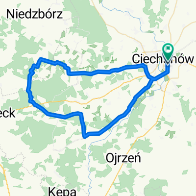
 Ciechanów i okolice
- Distance
- 31.7 km
- Ascent
- 99 m
- Descent
- 99 m
- Location
- Ciechanów, Masovian Voivodeship, Poland
 SP4 Ciechanów - Krusz
- Distance
- 53.4 km
- Ascent
- 157 m
- Descent
- 162 m
- Location
- Ciechanów, Masovian Voivodeship, Poland
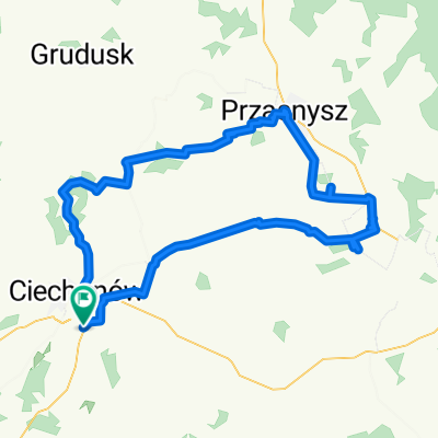 Ciechanów Krasne Rostkowo
- Distance
- 96.6 km
- Ascent
- 341 m
- Descent
- 391 m
- Location
- Ciechanów, Masovian Voivodeship, Poland
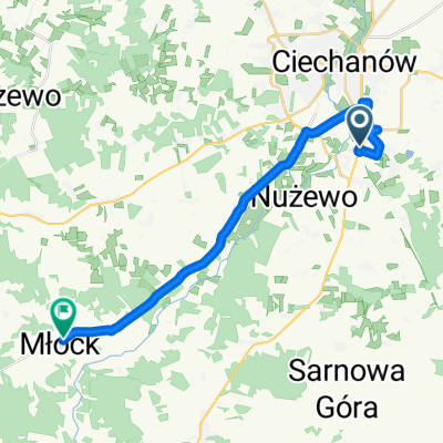
 Ciechanów Kraszewo Luberadz Młock Lub
- Distance
- 73 km
- Ascent
- 256 m
- Descent
- 297 m
- Location
- Ciechanów, Masovian Voivodeship, Poland
 Ciechanów Pazibroda Opinogóra
- Distance
- 83.3 km
- Ascent
- 164 m
- Descent
- 162 m
- Location
- Ciechanów, Masovian Voivodeship, Poland
 Płaciszewo Malużyn Sulerzyż
- Distance
- 73.4 km
- Ascent
- 205 m
- Descent
- 207 m
- Location
- Ciechanów, Masovian Voivodeship, Poland
Open it in the app