

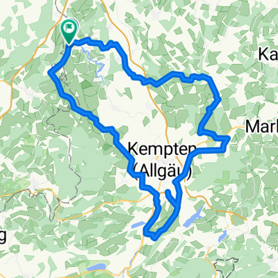
LAU-Neumühle Alturied Hängebrücke Rothenstein Oberbinwang Lautrach
A cycling route starting in Lautrach, Bavaria, Germany.
Overview
About this route
Bergiges Vergnügen,
Landschaftlich schöne Ausblicke ins Allgäu,
unterschiedlichste Wege ,
Nach der Hängebrücke in Alturied darf das Fahrrad die Treppen hinaufgetragen werden.
Statt über Grönenbach zu fahren eine abenteuerliche Waldabfahrt nach Rothenstein.
- -:--
- Duration
- 45.5 km
- Distance
- 421 m
- Ascent
- 418 m
- Descent
- ---
- Avg. speed
- ---
- Max. altitude
Continue with Bikemap
Use, edit, or download this cycling route
You would like to ride LAU-Neumühle Alturied Hängebrücke Rothenstein Oberbinwang Lautrach or customize it for your own trip? Here is what you can do with this Bikemap route:
Free features
- Save this route as favorite or in collections
- Copy & plan your own version of this route
- Sync your route with Garmin or Wahoo
Premium features
Free trial for 3 days, or one-time payment. More about Bikemap Premium.
- Navigate this route on iOS & Android
- Export a GPX / KML file of this route
- Create your custom printout (try it for free)
- Download this route for offline navigation
Discover more Premium features.
Get Bikemap PremiumFrom our community
Other popular routes starting in Lautrach
 LAU-KAR-VOLK-BRUNNEN-TREHERZ-LAU
- Distance
- 26.8 km
- Ascent
- 293 m
- Descent
- 295 m
- Location
- Lautrach, Bavaria, Germany
 2019-07-06
- Distance
- 62.1 km
- Ascent
- 339 m
- Descent
- 339 m
- Location
- Lautrach, Bavaria, Germany
 LAU-Neumühle Alturied Hängebrücke Rothenstein Oberbinwang Lautrach
- Distance
- 45.5 km
- Ascent
- 421 m
- Descent
- 418 m
- Location
- Lautrach, Bavaria, Germany
 2019-07-20
- Distance
- 78.4 km
- Ascent
- 401 m
- Descent
- 401 m
- Location
- Lautrach, Bavaria, Germany
 Runde (Illerweg + alte Bahnstrecke)
- Distance
- 29.2 km
- Ascent
- 214 m
- Descent
- 216 m
- Location
- Lautrach, Bavaria, Germany
 Ottmannshausen-Brunch
- Distance
- 21.4 km
- Ascent
- 271 m
- Descent
- 272 m
- Location
- Lautrach, Bavaria, Germany
 2025-05-24
- Distance
- 128.8 km
- Ascent
- 1,765 m
- Descent
- 1,766 m
- Location
- Lautrach, Bavaria, Germany
 Lautrach-Oberbinw-Rechberg-Au-Legau-Lau
- Distance
- 22.9 km
- Ascent
- 215 m
- Descent
- 215 m
- Location
- Lautrach, Bavaria, Germany
Open it in the app