
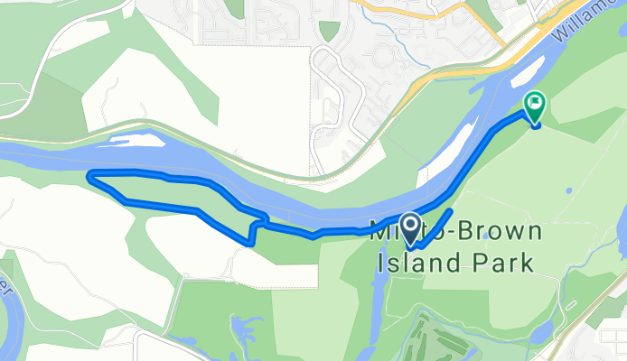
Minto Browns
A cycling route starting in Salem, Oregon, United States.
Overview
About this route
- -:--
- Duration
- 7.6 km
- Distance
- 19 m
- Ascent
- 18 m
- Descent
- ---
- Avg. speed
- 47 m
- Max. altitude

Route quality
Waytypes & surfaces along the route
Waytypes
Path
5.7 km
(75 %)
Pedestrian area
1.9 km
(25 %)
Surfaces
Paved
3.2 km
(42 %)
Unpaved
4.4 km
(58 %)
Paved (undefined)
3.2 km
(42 %)
Gravel
2.5 km
(33 %)
Ground
1.9 km
(25 %)
Continue with Bikemap
Use, edit, or download this cycling route
You would like to ride Minto Browns or customize it for your own trip? Here is what you can do with this Bikemap route:
Free features
- Save this route as favorite or in collections
- Copy & plan your own version of this route
- Sync your route with Garmin or Wahoo
Premium features
Free trial for 3 days, or one-time payment. More about Bikemap Premium.
- Navigate this route on iOS & Android
- Export a GPX / KML file of this route
- Create your custom printout (try it for free)
- Download this route for offline navigation
Discover more Premium features.
Get Bikemap PremiumFrom our community
Other popular routes starting in Salem
 Reach the Beach via Wine Country May 2020
- Distance
- 166.6 km
- Ascent
- 890 m
- Descent
- 940 m
- Location
- Salem, Oregon, United States
 Waldo Hills Area
- Distance
- 49 km
- Ascent
- 217 m
- Descent
- 217 m
- Location
- Salem, Oregon, United States
 2806 Homestead Rd S, Salem to 2701–2903 Homestead Rd S, Salem
- Distance
- 44.5 km
- Ascent
- 217 m
- Descent
- 218 m
- Location
- Salem, Oregon, United States
 Salem - Monmouth Route
- Distance
- 47.3 km
- Ascent
- 198 m
- Descent
- 192 m
- Location
- Salem, Oregon, United States
 2928 Gehlar Rd NW, Salem to 390 High St NE, Salem
- Distance
- 5.6 km
- Ascent
- 18 m
- Descent
- 116 m
- Location
- Salem, Oregon, United States
 Enchanted forest
- Distance
- 11.2 km
- Ascent
- 158 m
- Descent
- 165 m
- Location
- Salem, Oregon, United States
 SBC - Drift Creek Loop II (Map 0409)
- Distance
- 68.8 km
- Ascent
- 459 m
- Descent
- 459 m
- Location
- Salem, Oregon, United States
 NWTR 2012 Sat Short Ride
- Distance
- 30.3 km
- Ascent
- 43 m
- Descent
- 45 m
- Location
- Salem, Oregon, United States
Open it in the app