

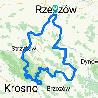
Rzeszów-Wilcze-Rzeszów
A cycling route starting in Rzeszów, Subcarpathian Voivodeship, Poland.
Overview
About this route
Rzeszów, Dynów Foothills, Wilcze, Straszydle, Tyczyn, Hermanowa
- -:--
- Duration
- 60 km
- Distance
- 569 m
- Ascent
- 569 m
- Descent
- ---
- Avg. speed
- ---
- Max. altitude

Route quality
Waytypes & surfaces along the route
Waytypes
Road
21.6 km
(36 %)
Quiet road
18 km
(30 %)
Surfaces
Paved
44.4 km
(74 %)
Unpaved
4.2 km
(7 %)
Asphalt
43.8 km
(73 %)
Gravel
1.8 km
(3 %)
Route highlights
Points of interest along the route
Point of interest after 27.8 km
punkt widokowy
Point of interest after 31.4 km
punkt widokowy Wilcze
Continue with Bikemap
Use, edit, or download this cycling route
You would like to ride Rzeszów-Wilcze-Rzeszów or customize it for your own trip? Here is what you can do with this Bikemap route:
Free features
- Save this route as favorite or in collections
- Copy & plan your own version of this route
- Sync your route with Garmin or Wahoo
Premium features
Free trial for 3 days, or one-time payment. More about Bikemap Premium.
- Navigate this route on iOS & Android
- Export a GPX / KML file of this route
- Create your custom printout (try it for free)
- Download this route for offline navigation
Discover more Premium features.
Get Bikemap PremiumFrom our community
Other popular routes starting in Rzeszów
 Rzeszów Hermanowa Rzeszów
- Distance
- 34 km
- Ascent
- 238 m
- Descent
- 238 m
- Location
- Rzeszów, Subcarpathian Voivodeship, Poland
 Rzeszów-Wilcze-Rzeszów
- Distance
- 60 km
- Ascent
- 569 m
- Descent
- 569 m
- Location
- Rzeszów, Subcarpathian Voivodeship, Poland
 Podjazd na Łany
- Distance
- 15.4 km
- Ascent
- 236 m
- Descent
- 233 m
- Location
- Rzeszów, Subcarpathian Voivodeship, Poland
 #3 Rzeszow - Strzyzow (Zglobien, Czudec, Strzyzow, Lubenia)
- Distance
- 80.1 km
- Ascent
- 631 m
- Descent
- 632 m
- Location
- Rzeszów, Subcarpathian Voivodeship, Poland
 Kopce Jasienickie - szkic
- Distance
- 150.4 km
- Ascent
- 1,355 m
- Descent
- 1,358 m
- Location
- Rzeszów, Subcarpathian Voivodeship, Poland
 Rzeszów - Albigowa - Rzeszów
- Distance
- 63.2 km
- Ascent
- 417 m
- Descent
- 417 m
- Location
- Rzeszów, Subcarpathian Voivodeship, Poland
 Mroźna wyprawa
- Distance
- 48.5 km
- Ascent
- 87 m
- Descent
- 87 m
- Location
- Rzeszów, Subcarpathian Voivodeship, Poland
 Bieszczadzka majówka
- Distance
- 274.8 km
- Ascent
- 3,568 m
- Descent
- 3,208 m
- Location
- Rzeszów, Subcarpathian Voivodeship, Poland
Open it in the app