
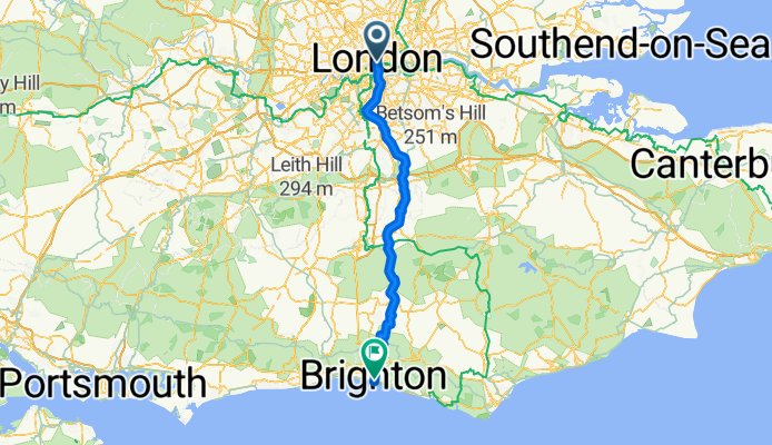
lfgss - london to b-right-on
A cycling route starting in London, England, United Kingdom.
Overview
About this route
08/05/11
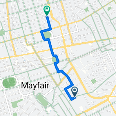
lfgss ride from london to trafalgar square.
- -:--
- Duration
- 95.9 km
- Distance
- 673 m
- Ascent
- 679 m
- Descent
- ---
- Avg. speed
- ---
- Avg. speed
Route quality
Waytypes & surfaces along the route
Waytypes
Busy road
32.9 km
(34 %)
Road
22.3 km
(23 %)
Surfaces
Paved
69.3 km
(72 %)
Asphalt
65 km
(68 %)
Paved (undefined)
2.2 km
(2 %)
Continue with Bikemap
Use, edit, or download this cycling route
You would like to ride lfgss - london to b-right-on or customize it for your own trip? Here is what you can do with this Bikemap route:
Free features
- Save this route as favorite or in collections
- Copy & plan your own version of this route
- Split it into stages to create a multi-day tour
- Sync your route with Garmin or Wahoo
Premium features
Free trial for 3 days, or one-time payment. More about Bikemap Premium.
- Navigate this route on iOS & Android
- Export a GPX / KML file of this route
- Create your custom printout (try it for free)
- Download this route for offline navigation
Discover more Premium features.
Get Bikemap PremiumFrom our community
Other popular routes starting in London
 Burlington Arcade, London to Bridgewick Road, Southminster
- Distance
- 109.5 km
- Ascent
- 452 m
- Descent
- 483 m
- Location
- London, England, United Kingdom
 Burlington Arcade, London to Willey, Presteigne
- Distance
- 300.9 km
- Ascent
- 2,930 m
- Descent
- 2,696 m
- Location
- London, England, United Kingdom
 27 Neal Street, London to Bucknall Street, London
- Distance
- 0.4 km
- Ascent
- 3 m
- Descent
- 4 m
- Location
- London, England, United Kingdom
 228 Piccadilly, London to 5–9 Great Windmill St, London
- Distance
- 0.2 km
- Ascent
- 0 m
- Descent
- 4 m
- Location
- London, England, United Kingdom
 Mens Womens Olympic Cycle Road Race Route
- Distance
- 124.7 km
- Ascent
- 574 m
- Descent
- 577 m
- Location
- London, England, United Kingdom
 228 Piccadilly, London to 14-28 Oxford St, London
- Distance
- 1 km
- Ascent
- 0 m
- Descent
- 4 m
- Location
- London, England, United Kingdom
 Mocked GeoReverse Location to Mocked GeoReverse Location
- Distance
- 209.5 km
- Ascent
- 1,346 m
- Descent
- 1,356 m
- Location
- London, England, United Kingdom
 Burlington Gardens, London to Euston Road, London
- Distance
- 1.4 km
- Ascent
- 7 m
- Descent
- 4 m
- Location
- London, England, United Kingdom
Open it in the app