

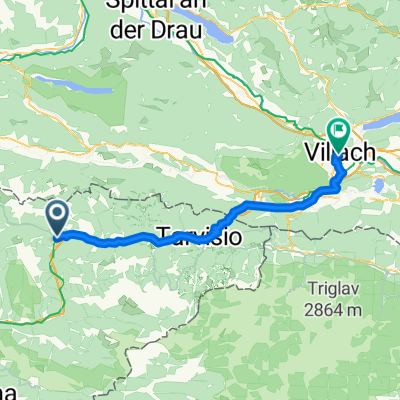
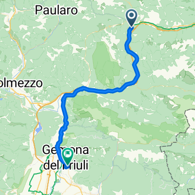
2021 Nassfeldpass
A cycling route starting in Pontebba, Friuli Venezia Giulia, Italy.
Overview
About this route
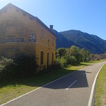
Pötyi utvonal :) Nassfeld hágóút megmászása Pontebbából. Alpok a hármashatáron (Passo Pramollo)
- -:--
- Duration
- 98.4 km
- Distance
- 1,256 m
- Ascent
- 1,255 m
- Descent
- ---
- Avg. speed
- 1,529 m
- Max. altitude

Route quality
Waytypes & surfaces along the route
Waytypes
Cycleway
31.5 km
(32 %)
Quiet road
16.7 km
(17 %)
Surfaces
Paved
74.8 km
(76 %)
Unpaved
2 km
(2 %)
Asphalt
69.8 km
(71 %)
Paved (undefined)
4.9 km
(5 %)
Continue with Bikemap
Use, edit, or download this cycling route
You would like to ride 2021 Nassfeldpass or customize it for your own trip? Here is what you can do with this Bikemap route:
Free features
- Save this route as favorite or in collections
- Copy & plan your own version of this route
- Split it into stages to create a multi-day tour
- Sync your route with Garmin or Wahoo
Premium features
Free trial for 3 days, or one-time payment. More about Bikemap Premium.
- Navigate this route on iOS & Android
- Export a GPX / KML file of this route
- Create your custom printout (try it for free)
- Download this route for offline navigation
Discover more Premium features.
Get Bikemap PremiumFrom our community
Other popular routes starting in Pontebba
 giro del Friuli
- Distance
- 137.1 km
- Ascent
- 2,048 m
- Descent
- 2,092 m
- Location
- Pontebba, Friuli Venezia Giulia, Italy
 Via Cavour to Via Marconi
- Distance
- 1.4 km
- Ascent
- 15 m
- Descent
- 13 m
- Location
- Pontebba, Friuli Venezia Giulia, Italy
 Ponteba-Ovaro-Aupa
- Distance
- 126.5 km
- Ascent
- 2,387 m
- Descent
- 2,384 m
- Location
- Pontebba, Friuli Venezia Giulia, Italy
 Pontebba fino a Dongna con i bambini
- Distance
- 22.9 km
- Ascent
- 473 m
- Descent
- 466 m
- Location
- Pontebba, Friuli Venezia Giulia, Italy
 Pontebba-Villach
- Distance
- 56.2 km
- Ascent
- 814 m
- Descent
- 885 m
- Location
- Pontebba, Friuli Venezia Giulia, Italy
 Dolomiti E1
- Distance
- 95.9 km
- Ascent
- 4,053 m
- Descent
- 3,900 m
- Location
- Pontebba, Friuli Venezia Giulia, Italy
 Pontebbana Radweg von Tarvis nach Cividale
- Distance
- 45.3 km
- Ascent
- 730 m
- Descent
- 1,083 m
- Location
- Pontebba, Friuli Venezia Giulia, Italy
 2021 Nassfeldpass
- Distance
- 98.4 km
- Ascent
- 1,256 m
- Descent
- 1,255 m
- Location
- Pontebba, Friuli Venezia Giulia, Italy
Open it in the app