

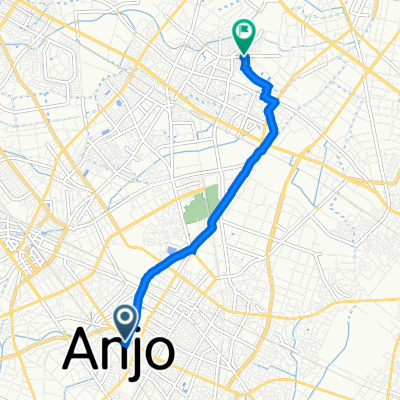
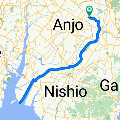
矢作川沿い~河口
A cycling route starting in Anjo, Aichi, Japan.
Overview
About this route
Overall length of 60 km
I haven't been there, but it seems that there is little traffic and it's easy to ride. The road is almost flat, so it shouldn't be as tiring as the distance suggests.
If it's sunny, the wind should feel nice. I'm a little worried about how strong the headwind might be.
It also seems possible to do clam digging at the estuary. The clams I catch can be tucked into my pocket to take home.
[Summary] Mom, this doesn't smell like squid, it smells like clams.
- -:--
- Duration
- 60.3 km
- Distance
- 78 m
- Ascent
- 78 m
- Descent
- ---
- Avg. speed
- ---
- Max. altitude
Route quality
Waytypes & surfaces along the route
Waytypes
Quiet road
41 km
(68 %)
Road
7.2 km
(12 %)
Surfaces
Paved
4.8 km
(8 %)
Paved (undefined)
3.6 km
(6 %)
Asphalt
1.2 km
(2 %)
Undefined
55.5 km
(92 %)
Continue with Bikemap
Use, edit, or download this cycling route
You would like to ride 矢作川沿い~河口 or customize it for your own trip? Here is what you can do with this Bikemap route:
Free features
- Save this route as favorite or in collections
- Copy & plan your own version of this route
- Sync your route with Garmin or Wahoo
Premium features
Free trial for 3 days, or one-time payment. More about Bikemap Premium.
- Navigate this route on iOS & Android
- Export a GPX / KML file of this route
- Create your custom printout (try it for free)
- Download this route for offline navigation
Discover more Premium features.
Get Bikemap PremiumFrom our community
Other popular routes starting in Anjo
 8-1, 百石町 1-Chōme, 安城市 a 9-3, 里町 3-Chōme, 安城市
- Distance
- 5.6 km
- Ascent
- 20 m
- Descent
- 14 m
- Location
- Anjo, Aichi, Japan
 下之切, 豊田市 to 10丁目, 豊田市
- Distance
- 6.2 km
- Ascent
- 74 m
- Descent
- 51 m
- Location
- Anjo, Aichi, Japan
 矢作川沿い~河口
- Distance
- 60.3 km
- Ascent
- 78 m
- Descent
- 78 m
- Location
- Anjo, Aichi, Japan
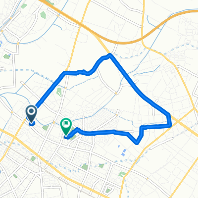
 安城_丈山苑
- Distance
- 7.3 km
- Ascent
- 32 m
- Descent
- 41 m
- Location
- Anjo, Aichi, Japan
 Nagoya
- Distance
- 30.4 km
- Ascent
- 114 m
- Descent
- 127 m
- Location
- Anjo, Aichi, Japan
 9, 里町 3-Chōme, 安城市 a 18-1, 長篠町 大山, 知立市
- Distance
- 5.8 km
- Ascent
- 20 m
- Descent
- 16 m
- Location
- Anjo, Aichi, Japan
 De 5, Imahommachi 7-Chōme, Anjo-Shi a 4, Satocho 4-Chōme, Anjo-Shi
- Distance
- 6.3 km
- Ascent
- 10 m
- Descent
- 16 m
- Location
- Anjo, Aichi, Japan
 De 5, Imahommachi 7-Chōme, Anjo-Shi a 5, Imahommachi 7-Chōme, Anjo-Shi
- Distance
- 7.6 km
- Ascent
- 44 m
- Descent
- 49 m
- Location
- Anjo, Aichi, Japan
Open it in the app