

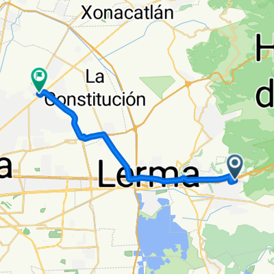
Rio Hondito
A cycling route starting in Ocoyoacac, Morelos, Mexico.
Overview
About this route
- 4 h 12 min
- Duration
- 13.3 km
- Distance
- 699 m
- Ascent
- 708 m
- Descent
- 3.2 km/h
- Avg. speed
- ---
- Max. altitude

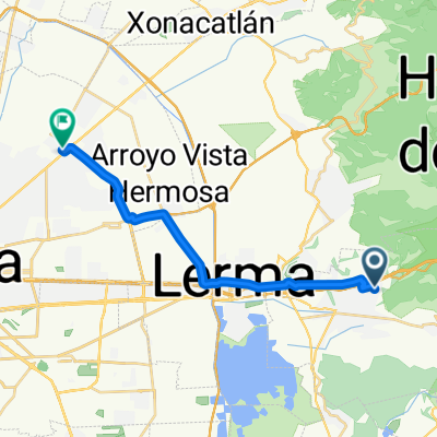
Route photos

Continue with Bikemap
Use, edit, or download this cycling route
You would like to ride Rio Hondito or customize it for your own trip? Here is what you can do with this Bikemap route:
Free features
- Save this route as favorite or in collections
- Copy & plan your own version of this route
- Sync your route with Garmin or Wahoo
Premium features
Free trial for 3 days, or one-time payment. More about Bikemap Premium.
- Navigate this route on iOS & Android
- Export a GPX / KML file of this route
- Create your custom printout (try it for free)
- Download this route for offline navigation
Discover more Premium features.
Get Bikemap PremiumFrom our community
Other popular routes starting in Ocoyoacac
 De Hacienda San Isidro a Emiliano Zapata
- Distance
- 21.9 km
- Ascent
- 153 m
- Descent
- 280 m
- Location
- Ocoyoacac, Morelos, Mexico
 Ocoyoacac - Cascada
- Distance
- 4.4 km
- Ascent
- 219 m
- Descent
- 65 m
- Location
- Ocoyoacac, Morelos, Mexico
 De ??õk? a ??õk?
- Distance
- 16.9 km
- Ascent
- 49 m
- Descent
- 37 m
- Location
- Ocoyoacac, Morelos, Mexico
 De Hacienda Pasteje a Mariano Matamoros F
- Distance
- 21.9 km
- Ascent
- 126 m
- Descent
- 261 m
- Location
- Ocoyoacac, Morelos, Mexico
 De Hacienda Pasteje a Emiliano Zapata
- Distance
- 22.5 km
- Ascent
- 149 m
- Descent
- 277 m
- Location
- Ocoyoacac, Morelos, Mexico
 Steady ride in Ocoyoacac
- Distance
- 11.5 km
- Ascent
- 232 m
- Descent
- 304 m
- Location
- Ocoyoacac, Morelos, Mexico
 Paseo lento en Ocoyoacac
- Distance
- 15.2 km
- Ascent
- 26 m
- Descent
- 26 m
- Location
- Ocoyoacac, Morelos, Mexico
 Rio Hondito
- Distance
- 13.3 km
- Ascent
- 699 m
- Descent
- 708 m
- Location
- Ocoyoacac, Morelos, Mexico
Open it in the app