

Winsen
- 35.1 km
- 78 m
- 71 m
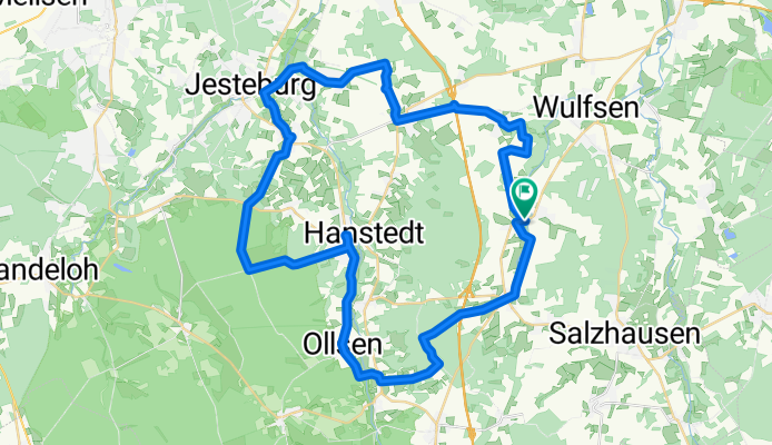
- Toppenstedt, Lower Saxony, Germany
A cycling route starting in Toppenstedt, Lower Saxony, Germany.
Overview
Startzeit: 11:01 27.06.2021 Zielzeit: 16:34 27.06.2021 Strecke: 48,4 km (05:33) Bewegungszeit: 03:40 Ø-Geschwindigkeit: 8,71 km/h Netto-Geschwindigkeit: 13,14 km/h Max. Geschwindigkeit: 28,63 km/h Minimale Höhe: 25 m Maximale Höhe: 140 m Steig-Geschw.: 461,5 m/h Sink-Geschw.: 792,6 m/h Aufstieg: 288 m Abstieg: 271 m Steigzeit: 00:37 Sinkzeit: 00:20
created this 4 years ago
Route quality
Track
27.4 km
(57 %)
Quiet road
13 km
(27 %)
Paved
25.5 km
(53 %)
Unpaved
19.7 km
(41 %)
Asphalt
19.7 km
(41 %)
Gravel
11.5 km
(24 %)
Continue with Bikemap
You would like to ride 2021-06-27 Heidetour Elke Hamann or customize it for your own trip? Here is what you can do with this Bikemap route:
Free trial for 3 days, or one-time payment. More about Bikemap Premium.
Discover more Premium features.
Get Bikemap PremiumFrom our community
Open it in the app


