

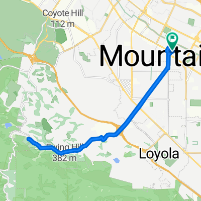
Tied House - Los Altos Hill Loop (Long)
A cycling route starting in Mountain View, California, United States.
Overview
About this route
- -:--
- Duration
- 45.1 km
- Distance
- 420 m
- Ascent
- 418 m
- Descent
- ---
- Avg. speed
- ---
- Max. altitude
Route quality
Waytypes & surfaces along the route
Waytypes
Road
11.7 km
(26 %)
Quiet road
5.4 km
(12 %)
Surfaces
Paved
28.8 km
(64 %)
Asphalt
28.8 km
(64 %)
Undefined
16.2 km
(36 %)
Continue with Bikemap
Use, edit, or download this cycling route
You would like to ride Tied House - Los Altos Hill Loop (Long) or customize it for your own trip? Here is what you can do with this Bikemap route:
Free features
- Save this route as favorite or in collections
- Copy & plan your own version of this route
- Sync your route with Garmin or Wahoo
Premium features
Free trial for 3 days, or one-time payment. More about Bikemap Premium.
- Navigate this route on iOS & Android
- Export a GPX / KML file of this route
- Create your custom printout (try it for free)
- Download this route for offline navigation
Discover more Premium features.
Get Bikemap PremiumFrom our community
Other popular routes starting in Mountain View
 Charleston & Mayfield Slough from Shoreline
- Distance
- 15.4 km
- Ascent
- 40 m
- Descent
- 37 m
- Location
- Mountain View, California, United States
 601–695 Leong Dr, Mountain View to 685 Leong Dr, Mountain View
- Distance
- 14.8 km
- Ascent
- 0 m
- Descent
- 6 m
- Location
- Mountain View, California, United States
 487 Thompson Ave, Mountain View to 2378 Jane Ln, Mountain View
- Distance
- 22 km
- Ascent
- 0 m
- Descent
- 6 m
- Location
- Mountain View, California, United States
 Los altos hills
- Distance
- 25.2 km
- Ascent
- 254 m
- Descent
- 254 m
- Location
- Mountain View, California, United States
 Moody quick
- Distance
- 19.1 km
- Ascent
- 233 m
- Descent
- 234 m
- Location
- Mountain View, California, United States
 2940 N Shoreline Blvd, Mountain View to 1109 N Fair Oaks Ave, Sunnyvale
- Distance
- 41.6 km
- Ascent
- 0 m
- Descent
- 3 m
- Location
- Mountain View, California, United States
 Route1
- Distance
- 51.6 km
- Ascent
- 699 m
- Descent
- 710 m
- Location
- Mountain View, California, United States
 Peter's Hilly MountainView Ride
- Distance
- 38 km
- Ascent
- 460 m
- Descent
- 458 m
- Location
- Mountain View, California, United States
Open it in the app