

Cosputener See, Pleiße-RW, Altenburg,
A cycling route starting in Altenburg, Thuringia, Germany.
Overview
About this route
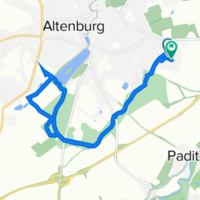
Nach Umrundung des Cosputener Sees in Markkleeberg auf Pleißeradweg nach Gaschwitz.<br /> Über Großdeuben, Böhlen, Rötha, Neukiertzsch nach Deutzen.<br /> Weiter nach Regis Breitingen, Hasselbach, Treben, Treben Lehma, Primmelwitz, Zschalschelwitz, Altenburg,
- -:--
- Duration
- 88.1 km
- Distance
- 171 m
- Ascent
- 191 m
- Descent
- ---
- Avg. speed
- 210 m
- Max. altitude
Route quality
Waytypes & surfaces along the route
Waytypes
Path
33.9 km
(38 %)
Quiet road
19.1 km
(22 %)
Surfaces
Paved
75.1 km
(85 %)
Unpaved
4 km
(5 %)
Asphalt
64 km
(73 %)
Paving stones
8.9 km
(10 %)
Continue with Bikemap
Use, edit, or download this cycling route
You would like to ride Cosputener See, Pleiße-RW, Altenburg, or customize it for your own trip? Here is what you can do with this Bikemap route:
Free features
- Save this route as favorite or in collections
- Copy & plan your own version of this route
- Split it into stages to create a multi-day tour
- Sync your route with Garmin or Wahoo
Premium features
Free trial for 3 days, or one-time payment. More about Bikemap Premium.
- Navigate this route on iOS & Android
- Export a GPX / KML file of this route
- Create your custom printout (try it for free)
- Download this route for offline navigation
Discover more Premium features.
Get Bikemap PremiumFrom our community
Other popular routes starting in Altenburg
 RTF "rund ums Altenburger Land"
- Distance
- 118.1 km
- Ascent
- 726 m
- Descent
- 720 m
- Location
- Altenburg, Thuringia, Germany
 Altenburg Südost - Sternengarten - Märchenbrunnen - zurück
- Distance
- 8.2 km
- Ascent
- 114 m
- Descent
- 112 m
- Location
- Altenburg, Thuringia, Germany
 Schloßberg 1B, Altenburg nach Wenzelstraße 43, Altenburg
- Distance
- 63.8 km
- Ascent
- 685 m
- Descent
- 768 m
- Location
- Altenburg, Thuringia, Germany
 Altenburg Polsterstein
- Distance
- 59 km
- Ascent
- 401 m
- Descent
- 442 m
- Location
- Altenburg, Thuringia, Germany
 Wenzelstraße 43, Altenburg nach Wenzelstraße 43, Altenburg
- Distance
- 44.5 km
- Ascent
- 248 m
- Descent
- 298 m
- Location
- Altenburg, Thuringia, Germany
 NightTrail ABG
- Distance
- 19 km
- Ascent
- 226 m
- Descent
- 226 m
- Location
- Altenburg, Thuringia, Germany
 2 RSG2019
- Distance
- 126.4 km
- Ascent
- 1,019 m
- Descent
- 698 m
- Location
- Altenburg, Thuringia, Germany
 Cosputener See, Pleiße-RW, Altenburg,
- Distance
- 88.1 km
- Ascent
- 171 m
- Descent
- 191 m
- Location
- Altenburg, Thuringia, Germany
Open it in the app