

Kurd, Vörösegyhaza, See, Kurd
A cycling route starting in Döbrököz, Tolna County, Hungary.
Overview
About this route
Teilweise unbefestigte Feldwege, die bei nassem Wetter schlecht zu befahren sind. Ansonsten eine landschaftlich schöne Strecke.
- -:--
- Duration
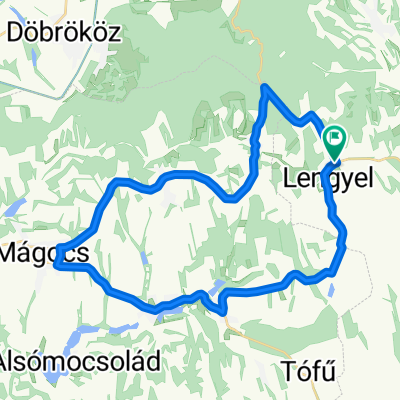
- 41.3 km
- Distance
- 299 m
- Ascent
- 299 m
- Descent
- ---
- Avg. speed
- ---
- Max. altitude

Route photos


Continue with Bikemap
Use, edit, or download this cycling route
You would like to ride Kurd, Vörösegyhaza, See, Kurd or customize it for your own trip? Here is what you can do with this Bikemap route:
Free features
- Save this route as favorite or in collections
- Copy & plan your own version of this route
- Sync your route with Garmin or Wahoo
Premium features
Free trial for 3 days, or one-time payment. More about Bikemap Premium.
- Navigate this route on iOS & Android
- Export a GPX / KML file of this route
- Create your custom printout (try it for free)
- Download this route for offline navigation
Discover more Premium features.
Get Bikemap PremiumFrom our community
Other popular routes starting in Döbrököz
 Kurd-Bonyhad-Szálka_See
- Distance
- 45.3 km
- Ascent
- 483 m
- Descent
- 448 m
- Location
- Döbrököz, Tolna County, Hungary
 Kurd, Gyulaj, Tamási
- Distance
- 28.8 km
- Ascent
- 225 m
- Descent
- 223 m
- Location
- Döbrököz, Tolna County, Hungary
 Kossuth Lajos utca 24, Kurd - 6532, Csibrák
- Distance
- 0.9 km
- Ascent
- 7 m
- Descent
- 77 m
- Location
- Döbrököz, Tolna County, Hungary
 Lengyel-Nagyhajmás-Mágocs-Egyházaskozár-Lengyel
- Distance
- 35.4 km
- Ascent
- 317 m
- Descent
- 317 m
- Location
- Döbrököz, Tolna County, Hungary
 Kurd nach Annafürdö
- Distance
- 11.6 km
- Ascent
- 193 m
- Descent
- 107 m
- Location
- Döbrököz, Tolna County, Hungary
 Kurd_Kapelle_Annabad_Kurd
- Distance
- 26.3 km
- Ascent
- 312 m
- Descent
- 312 m
- Location
- Döbrököz, Tolna County, Hungary
 Kurd_Tamasi_Kocsola_Kurd
- Distance
- 73.8 km
- Ascent
- 404 m
- Descent
- 406 m
- Location
- Döbrököz, Tolna County, Hungary
 Tolnai Zöldút 20220507
- Distance
- 37.9 km
- Ascent
- 691 m
- Descent
- 675 m
- Location
- Döbrököz, Tolna County, Hungary
Open it in the app