
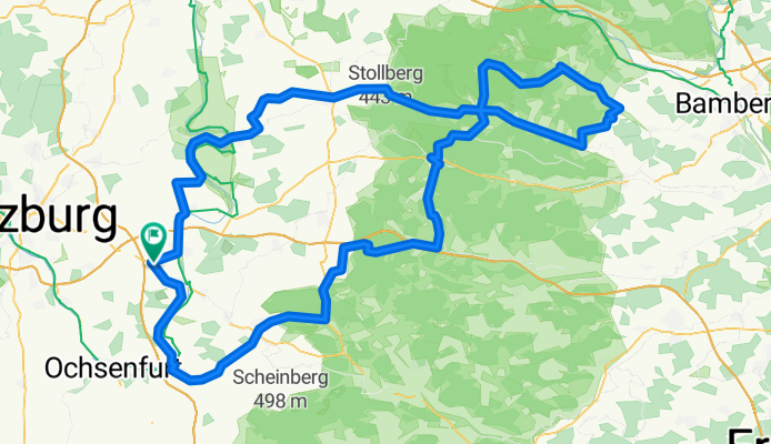
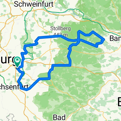
Bocksbeuteltour
A cycling route starting in Buchbrunn, Bavaria, Germany.
Overview
About this route
- -:--
- Duration
- 158.4 km
- Distance
- 1,491 m
- Ascent
- 1,546 m
- Descent
- ---
- Avg. speed
- 488 m
- Max. altitude
Route quality
Waytypes & surfaces along the route
Waytypes
Busy road
74.6 km
(47 %)
Road
45.6 km
(29 %)
Surfaces
Paved
78.9 km
(50 %)
Unpaved
5.7 km
(4 %)
Asphalt
76.7 km
(48 %)
Ground
3.1 km
(2 %)
Continue with Bikemap
Use, edit, or download this cycling route
You would like to ride Bocksbeuteltour or customize it for your own trip? Here is what you can do with this Bikemap route:
Free features
- Save this route as favorite or in collections
- Copy & plan your own version of this route
- Split it into stages to create a multi-day tour
- Sync your route with Garmin or Wahoo
Premium features
Free trial for 3 days, or one-time payment. More about Bikemap Premium.
- Navigate this route on iOS & Android
- Export a GPX / KML file of this route
- Create your custom printout (try it for free)
- Download this route for offline navigation
Discover more Premium features.
Get Bikemap PremiumFrom our community
Other popular routes starting in Buchbrunn
 Mainstockheim Estenfeld
- Distance
- 15.9 km
- Ascent
- 227 m
- Descent
- 186 m
- Location
- Buchbrunn, Bavaria, Germany
 BBTour 2013 Tour 4
- Distance
- 155.4 km
- Ascent
- 707 m
- Descent
- 705 m
- Location
- Buchbrunn, Bavaria, Germany
 Bocksbeuteltour 46 km
- Distance
- 46.2 km
- Ascent
- 238 m
- Descent
- 238 m
- Location
- Buchbrunn, Bavaria, Germany
 Bocksbeuteltour 2017
- Distance
- 120.9 km
- Ascent
- 609 m
- Descent
- 609 m
- Location
- Buchbrunn, Bavaria, Germany
 Kitzingen Boxbeuteltour 84
- Distance
- 84.6 km
- Ascent
- 513 m
- Descent
- 513 m
- Location
- Buchbrunn, Bavaria, Germany
 BB-Tour 120km 2012
- Distance
- 119.4 km
- Ascent
- 812 m
- Descent
- 812 m
- Location
- Buchbrunn, Bavaria, Germany
 Bocksbeutel 3
- Distance
- 121 km
- Ascent
- 1,140 m
- Descent
- 1,221 m
- Location
- Buchbrunn, Bavaria, Germany
 Bocksbeutel 4
- Distance
- 160 km
- Ascent
- 1,035 m
- Descent
- 1,035 m
- Location
- Buchbrunn, Bavaria, Germany
Open it in the app