

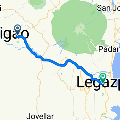
Ligao City Hall - Bonga Loop around Kawa-Kawa
A cycling route starting in Tuburan, Bicol Region, Philippines.
Overview
About this route
Berginner's route (for beginners like me). Route starts from the city center roads, then runs through the main highway. Then enters a rural road, this part of the route has some short-distance ascents followed by descents almost immediately, But always be careful of approaching vehicles especially that some parts are narrow and has descending sharp curves.
- -:--
- Duration
- 10.5 km
- Distance
- 77 m
- Ascent
- 76 m
- Descent
- ---
- Avg. speed
- 114 m
- Max. altitude

Route quality
Waytypes & surfaces along the route
Waytypes
Quiet road
6.1 km
(58 %)
Road
1.7 km
(16 %)
Continue with Bikemap
Use, edit, or download this cycling route
You would like to ride Ligao City Hall - Bonga Loop around Kawa-Kawa or customize it for your own trip? Here is what you can do with this Bikemap route:
Free features
- Save this route as favorite or in collections
- Copy & plan your own version of this route
- Sync your route with Garmin or Wahoo
Premium features
Free trial for 3 days, or one-time payment. More about Bikemap Premium.
- Navigate this route on iOS & Android
- Export a GPX / KML file of this route
- Create your custom printout (try it for free)
- Download this route for offline navigation
Discover more Premium features.
Get Bikemap PremiumFrom our community
Other popular routes starting in Tuburan
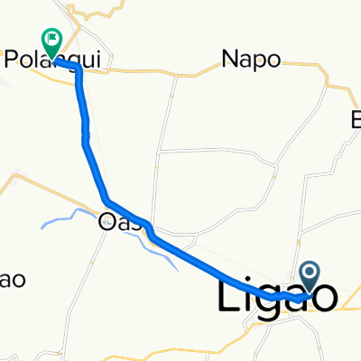
 Asian Highway 26, Ligao to 9P5J+P4J, Tabaco City
- Distance
- 28.9 km
- Ascent
- 288 m
- Descent
- 325 m
- Location
- Tuburan, Bicol Region, Philippines
 Easy ride
- Distance
- 1.4 km
- Ascent
- 11 m
- Descent
- 11 m
- Location
- Tuburan, Bicol Region, Philippines
 Ligao City Hall - Bonga Loop around Kawa-Kawa
- Distance
- 10.5 km
- Ascent
- 77 m
- Descent
- 76 m
- Location
- Tuburan, Bicol Region, Philippines
 Tuburan - Bariw
- Distance
- 27 km
- Ascent
- 163 m
- Descent
- 206 m
- Location
- Tuburan, Bicol Region, Philippines
 gjjug
gjjug- Distance
- 10.2 km
- Ascent
- 41 m
- Descent
- 56 m
- Location
- Tuburan, Bicol Region, Philippines
 Del Rosario Street 240, Ligao to Del Rosario Street 240, Ligao
- Distance
- 14.6 km
- Ascent
- 73 m
- Descent
- 71 m
- Location
- Tuburan, Bicol Region, Philippines
 Brgy Road, Ligao to Guinobatan 135
- Distance
- 7.3 km
- Ascent
- 131 m
- Descent
- 15 m
- Location
- Tuburan, Bicol Region, Philippines
 Daang Maharlika Highway, Ligao City to Municipal Road, Oas
- Distance
- 106.6 km
- Ascent
- 35 m
- Descent
- 73 m
- Location
- Tuburan, Bicol Region, Philippines
Open it in the app