

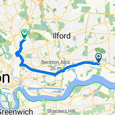
Goodmayes to Eastbrookend and the Chase nature reserve
A cycling route starting in Becontree, England, United Kingdom.
Overview
About this route
- -:--
- Duration
- 12.1 km
- Distance
- 24 m
- Ascent
- 23 m
- Descent
- ---
- Avg. speed
- 18 m
- Max. altitude

Route quality
Waytypes & surfaces along the route
Waytypes
Quiet road
4.6 km
(38 %)
Road
3 km
(25 %)
Surfaces
Paved
2.4 km
(20 %)
Unpaved
0.7 km
(6 %)
Asphalt
2.2 km
(18 %)
Gravel
0.7 km
(6 %)
Continue with Bikemap
Use, edit, or download this cycling route
You would like to ride Goodmayes to Eastbrookend and the Chase nature reserve or customize it for your own trip? Here is what you can do with this Bikemap route:
Free features
- Save this route as favorite or in collections
- Copy & plan your own version of this route
- Sync your route with Garmin or Wahoo
Premium features
Free trial for 3 days, or one-time payment. More about Bikemap Premium.
- Navigate this route on iOS & Android
- Export a GPX / KML file of this route
- Create your custom printout (try it for free)
- Download this route for offline navigation
Discover more Premium features.
Get Bikemap PremiumFrom our community
Other popular routes starting in Becontree
 Scrattons Terrace, Barking to Trumpington Road, London
- Distance
- 14 km
- Ascent
- 35 m
- Descent
- 25 m
- Location
- Becontree, England, United Kingdom
 Dag to Greenwich
- Distance
- 15.6 km
- Ascent
- 47 m
- Descent
- 53 m
- Location
- Becontree, England, United Kingdom
 Moderate route in Ilford
- Distance
- 5.5 km
- Ascent
- 10 m
- Descent
- 14 m
- Location
- Becontree, England, United Kingdom
 Wood Lane 481A to Temple Avenue 83
- Distance
- 14.2 km
- Ascent
- 117 m
- Descent
- 160 m
- Location
- Becontree, England, United Kingdom
 51 Cartwright Road, Dagenham to 49 Cartwright Road, Dagenham
- Distance
- 19.8 km
- Ascent
- 54 m
- Descent
- 54 m
- Location
- Becontree, England, United Kingdom
 360–382 Goresbrook Road, London to 129 Burdetts Road, Dagenham
- Distance
- 28.8 km
- Ascent
- 43 m
- Descent
- 49 m
- Location
- Becontree, England, United Kingdom
 Moderate route in Dagenham
- Distance
- 15 km
- Ascent
- 0 m
- Descent
- 4 m
- Location
- Becontree, England, United Kingdom
 Goodmayes to Eastbrookend and the Chase nature reserve
- Distance
- 12.1 km
- Ascent
- 24 m
- Descent
- 23 m
- Location
- Becontree, England, United Kingdom
Open it in the app