Naburn Bridge to Tesco A64 v Bigin for lunch.
- 53.8 km
- 93 m
- 84 m
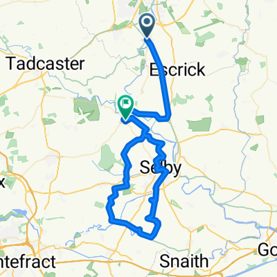
- Bishopthorpe, England, United Kingdom
A cycling route starting in Bishopthorpe, England, United Kingdom.
Overview
The more information you write here, the more you help other users with your route.<br /><br />Flat, mainly paved sustrans route over Burn air field bumpy.
Exhibition Square to Naburn Bridge v cycle track 5.1 m.
created this 14 years ago
Route quality
Quiet road
31 km
(53 %)
Cycleway
12.9 km
(22 %)
Paved
21 km
(36 %)
Unpaved
1.8 km
(3 %)
Asphalt
17.5 km
(30 %)
Paved (undefined)
3.5 km
(6 %)
Continue with Bikemap
You would like to ride WW Run April 13 2011 or customize it for your own trip? Here is what you can do with this Bikemap route:
Free trial for 3 days, or one-time payment. More about Bikemap Premium.
Discover more Premium features.
Get Bikemap PremiumFrom our community
Open it in the app