

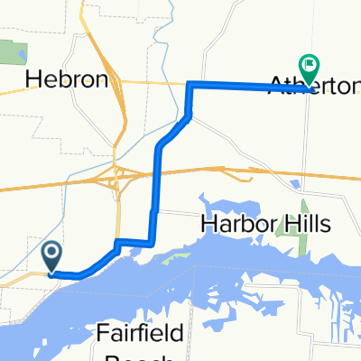
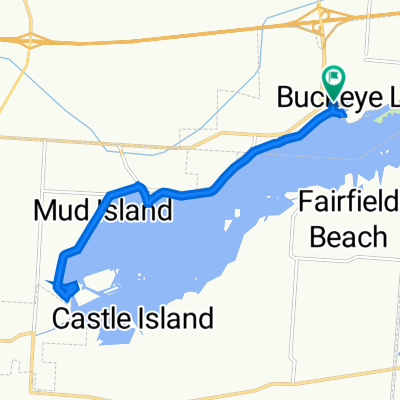
4455 Walnut Rd, Buckeye Lake to 5475 National Rd SE, Hebron
A cycling route starting in Buckeye Lake, Ohio, United States of America.
Overview
About this route
- 34 min
- Duration
- 7.8 km
- Distance
- 26 m
- Ascent
- 6 m
- Descent
- 13.8 km/h
- Avg. speed
- ---
- Max. altitude

Route quality
Waytypes & surfaces along the route
Waytypes
Busy road
3.3 km
(42 %)
Road
2.7 km
(35 %)
Surfaces
Paved
0.8 km
(11 %)
Asphalt
0.8 km
(11 %)
Undefined
6.9 km
(89 %)
Continue with Bikemap
Use, edit, or download this cycling route
You would like to ride 4455 Walnut Rd, Buckeye Lake to 5475 National Rd SE, Hebron or customize it for your own trip? Here is what you can do with this Bikemap route:
Free features
- Save this route as favorite or in collections
- Copy & plan your own version of this route
- Sync your route with Garmin or Wahoo
Premium features
Free trial for 3 days, or one-time payment. More about Bikemap Premium.
- Navigate this route on iOS & Android
- Export a GPX / KML file of this route
- Create your custom printout (try it for free)
- Download this route for offline navigation
Discover more Premium features.
Get Bikemap PremiumFrom our community
Other popular routes starting in Buckeye Lake
 Julia Street 29, Hebron to South Main Street 484, Granville
- Distance
- 22.8 km
- Ascent
- 91 m
- Descent
- 93 m
- Location
- Buckeye Lake, Ohio, United States of America
 5519 N Shore Landing, Buckeye Lake to 5519 N Shore Landing, Buckeye Lake
- Distance
- 14.8 km
- Ascent
- 9 m
- Descent
- 10 m
- Location
- Buckeye Lake, Ohio, United States of America
 4455 Walnut Rd, Buckeye Lake to 5475 National Rd SE, Hebron
- Distance
- 7.8 km
- Ascent
- 26 m
- Descent
- 6 m
- Location
- Buckeye Lake, Ohio, United States of America
 62–98 Grandstaff Ave, Buckeye Lake to 62–98 Grandstaff Ave, Buckeye Lake
- Distance
- 14.1 km
- Ascent
- 65 m
- Descent
- 64 m
- Location
- Buckeye Lake, Ohio, United States of America
Open it in the app