Oas-Ponso Loop Clockwise
A cycling route starting in Iraya, Bicol, Philippines.
Overview
About this route
- 1 h 43 min
- Duration
- 20.3 km
- Distance
- 43 m
- Ascent
- 41 m
- Descent
- 11.9 km/h
- Avg. speed
- ---
- Avg. speed
Route photos
Continue with Bikemap
Use, edit, or download this cycling route
You would like to ride Oas-Ponso Loop Clockwise or customize it for your own trip? Here is what you can do with this Bikemap route:
Free features
- Save this route as favorite or in collections
- Copy & plan your own version of this route
- Sync your route with Garmin or Wahoo
Premium features
Free trial for 3 days, or one-time payment. More about Bikemap Premium.
- Navigate this route on iOS & Android
- Export a GPX / KML file of this route
- Create your custom printout (try it for free)
- Download this route for offline navigation
Discover more Premium features.
Get Bikemap PremiumFrom our community
Other popular routes starting in Iraya
- Municipal Road, Oas to Municipal Road, Oas
- Distance
- 53.4 km
- Ascent
- 53 m
- Descent
- 46 m
- Location
- Iraya, Bicol, Philippines
- Maporong, Oas to Maporong, Oas
- Distance
- 12.3 km
- Ascent
- 391 m
- Descent
- 391 m
- Location
- Iraya, Bicol, Philippines
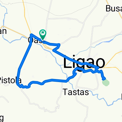
- Tobgon River Loop avoiding National Hi-ways and Dense Roads
- Distance
- 15.7 km
- Ascent
- 56 m
- Descent
- 55 m
- Location
- Iraya, Bicol, Philippines
- Municipal Road, Oas to Municipal Road, Oas
- Distance
- 14.7 km
- Ascent
- 9 m
- Descent
- 49 m
- Location
- Iraya, Bicol, Philippines
- Restful route
- Distance
- 22.8 km
- Ascent
- 126 m
- Descent
- 180 m
- Location
- Iraya, Bicol, Philippines
- Municipal Road, Oas to Municipal Road, Oas
- Distance
- 18.2 km
- Ascent
- 0 m
- Descent
- 7 m
- Location
- Iraya, Bicol, Philippines
- Oas-Ponso Loop Clockwise
- Distance
- 20.3 km
- Ascent
- 43 m
- Descent
- 41 m
- Location
- Iraya, Bicol, Philippines
- Municipal Road, Oas to Municipal Road, Oas
- Distance
- 39 km
- Ascent
- 254 m
- Descent
- 255 m
- Location
- Iraya, Bicol, Philippines
Open it in the app