

Maternusstraße, Pomster nach Eifelstraße 51, Laubach
A cycling route starting in Pomster, Rhineland-Palatinate, Germany.
Overview
About this route
- 2 h 34 min
- Duration
- 29.6 km
- Distance
- 650 m
- Ascent
- 538 m
- Descent
- 11.5 km/h
- Avg. speed
- ---
- Max. altitude
Route quality
Waytypes & surfaces along the route
Waytypes
Track
13.5 km
(46 %)
Busy road
7.7 km
(26 %)
Surfaces
Paved
25.2 km
(85 %)
Unpaved
2.2 km
(8 %)
Asphalt
24.6 km
(83 %)
Gravel
1.6 km
(5 %)
Continue with Bikemap
Use, edit, or download this cycling route
You would like to ride Maternusstraße, Pomster nach Eifelstraße 51, Laubach or customize it for your own trip? Here is what you can do with this Bikemap route:
Free features
- Save this route as favorite or in collections
- Copy & plan your own version of this route
- Sync your route with Garmin or Wahoo
Premium features
Free trial for 3 days, or one-time payment. More about Bikemap Premium.
- Navigate this route on iOS & Android
- Export a GPX / KML file of this route
- Create your custom printout (try it for free)
- Download this route for offline navigation
Discover more Premium features.
Get Bikemap PremiumFrom our community
Other popular routes starting in Pomster
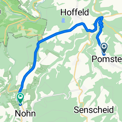 Maternusstraße 75, Pomster nach Adenauer Straße 5, Nohn
- Distance
- 9.5 km
- Ascent
- 88 m
- Descent
- 194 m
- Location
- Pomster, Rhineland-Palatinate, Germany
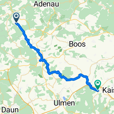 Maternusstraße, Pomster nach Eifelstraße 51, Laubach
- Distance
- 29.6 km
- Ascent
- 650 m
- Descent
- 538 m
- Location
- Pomster, Rhineland-Palatinate, Germany
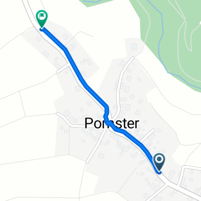 Maternusstraße 111, Pomster nach Maternusstraße 75, Pomster
- Distance
- 0.6 km
- Ascent
- 0 m
- Descent
- 6 m
- Location
- Pomster, Rhineland-Palatinate, Germany
 K3, Pomster nach Am Freilinger See 401, Blankenheim
- Distance
- 20.1 km
- Ascent
- 385 m
- Descent
- 342 m
- Location
- Pomster, Rhineland-Palatinate, Germany
Open it in the app