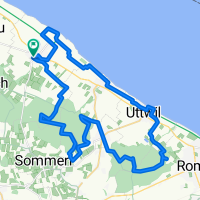
Recovered Route
A cycling route starting in Güttingen, Thurgau, Switzerland.
Overview
About this route
- 1 h 56 min
- Duration
- 40.8 km
- Distance
- 397 m
- Ascent
- 396 m
- Descent
- 21.2 km/h
- Avg. speed
- ---
- Avg. speed
Route quality
Waytypes & surfaces along the route
Waytypes
Quiet road
11.3 km
(28 %)
Track
10.2 km
(25 %)
Surfaces
Paved
22.2 km
(54 %)
Unpaved
4.8 km
(12 %)
Asphalt
21.8 km
(54 %)
Gravel
3.3 km
(8 %)
Continue with Bikemap
Use, edit, or download this cycling route
You would like to ride Recovered Route or customize it for your own trip? Here is what you can do with this Bikemap route:
Free features
- Save this route as favorite or in collections
- Copy & plan your own version of this route
- Sync your route with Garmin or Wahoo
Premium features
Free trial for 3 days, or one-time payment. More about Bikemap Premium.
- Navigate this route on iOS & Android
- Export a GPX / KML file of this route
- Create your custom printout (try it for free)
- Download this route for offline navigation
Discover more Premium features.
Get Bikemap PremiumFrom our community
Other popular routes starting in Güttingen
- Hauptstrasse 54, Güttingen nach Seepromenade 11, Meersburg
- Distance
- 21.1 km
- Ascent
- 27 m
- Descent
- 58 m
- Location
- Güttingen, Thurgau, Switzerland
- Seeweg 20, Güttingen nach Allgäustraße 126, Hörbranz
- Distance
- 68 km
- Ascent
- 382 m
- Descent
- 311 m
- Location
- Güttingen, Thurgau, Switzerland
- Unterkunft 1. Etappe
- Distance
- 6.7 km
- Ascent
- 134 m
- Descent
- 9 m
- Location
- Güttingen, Thurgau, Switzerland
- Lengthy bike tour from 9 Agosto 09:22
- Distance
- 97 km
- Ascent
- 298 m
- Descent
- 283 m
- Location
- Güttingen, Thurgau, Switzerland
- Recovered Route
- Distance
- 40.8 km
- Ascent
- 397 m
- Descent
- 396 m
- Location
- Güttingen, Thurgau, Switzerland
- Seeweg 20, Güttingen nach Bahnhofstrasse 54A, Romanshorn
- Distance
- 39.1 km
- Ascent
- 31,829 m
- Descent
- 31,807 m
- Location
- Güttingen, Thurgau, Switzerland
- Training 1
- Distance
- 69.1 km
- Ascent
- 568 m
- Descent
- 567 m
- Location
- Güttingen, Thurgau, Switzerland
- Seewies 23, Güttingen nach Staadweg, Güttingen
- Distance
- 48.1 km
- Ascent
- 13,751 m
- Descent
- 14,158 m
- Location
- Güttingen, Thurgau, Switzerland
Open it in the app