
Tour de Bourgogne
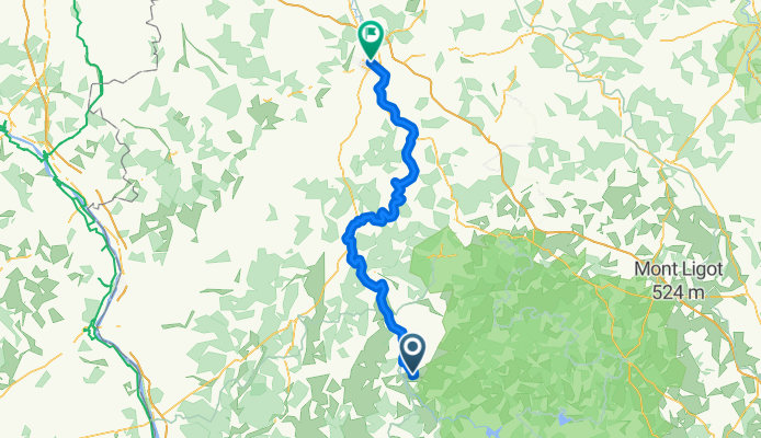
Etape 8 : Corbigny - Auxerre
A cycling route starting in Corbigny, Bourgogne-Franche-Comté, France.
Overview
About this route
- -:--
- Duration
- 97.8 km
- Distance
- 138 m
- Ascent
- 231 m
- Descent
- ---
- Avg. speed
- 220 m
- Max. altitude

Part of
Tour de Bourgogne
8 stages
Route quality
Waytypes & surfaces along the route
Waytypes
Cycleway
51.8 km
(53 %)
Path
21.5 km
(22 %)
Surfaces
Paved
83.1 km
(85 %)
Asphalt
78.2 km
(80 %)
Paved (undefined)
4.9 km
(5 %)
Undefined
14.7 km
(15 %)
Continue with Bikemap
Use, edit, or download this cycling route
You would like to ride Etape 8 : Corbigny - Auxerre or customize it for your own trip? Here is what you can do with this Bikemap route:
Free features
- Save this route as favorite or in collections
- Copy & plan your own version of this route
- Split it into stages to create a multi-day tour
- Sync your route with Garmin or Wahoo
Premium features
Free trial for 3 days, or one-time payment. More about Bikemap Premium.
- Navigate this route on iOS & Android
- Export a GPX / KML file of this route
- Create your custom printout (try it for free)
- Download this route for offline navigation
Discover more Premium features.
Get Bikemap PremiumFrom our community
Other popular routes starting in Corbigny
 Tour de France
- Distance
- 56.7 km
- Ascent
- 893 m
- Descent
- 553 m
- Location
- Corbigny, Bourgogne-Franche-Comté, France
 From Corbigny to Vézelay par st pere
- Distance
- 39.2 km
- Ascent
- 438 m
- Descent
- 363 m
- Location
- Corbigny, Bourgogne-Franche-Comté, France
 Etape 3 : bourgogne bis
- Distance
- 66.8 km
- Ascent
- 125 m
- Descent
- 114 m
- Location
- Corbigny, Bourgogne-Franche-Comté, France
 Long bike tour from Dirol to Cosne-Cours-sur-Loire
- Distance
- 79 km
- Ascent
- 283 m
- Descent
- 309 m
- Location
- Corbigny, Bourgogne-Franche-Comté, France
 Chitry-Bazoches-Vezelay-Clamecy-Canal Nivernays-Chitry
- Distance
- 90.2 km
- Ascent
- 554 m
- Descent
- 555 m
- Location
- Corbigny, Bourgogne-Franche-Comté, France
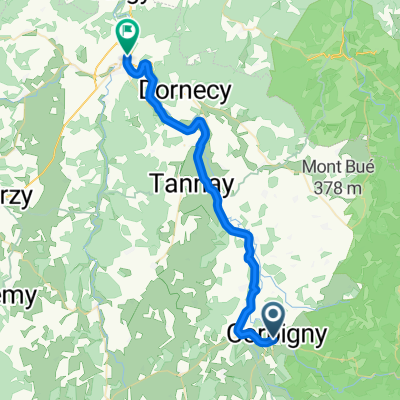 leg 3 Corbigny to Clamecy
- Distance
- 35.8 km
- Ascent
- 116 m
- Descent
- 179 m
- Location
- Corbigny, Bourgogne-Franche-Comté, France
 Chitry-Saint Révérien-Prémery-Bona-Saint Saulge-Étang de Baye-Chitry
- Distance
- 90.9 km
- Ascent
- 603 m
- Descent
- 602 m
- Location
- Corbigny, Bourgogne-Franche-Comté, France
 Corbigny to Premery
- Distance
- 35.1 km
- Ascent
- 421 m
- Descent
- 345 m
- Location
- Corbigny, Bourgogne-Franche-Comté, France
Open it in the app