

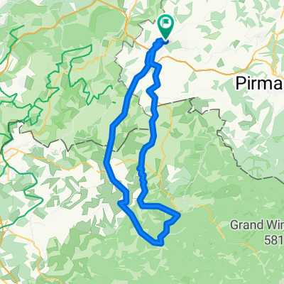
Rund: ZW, Battweiler, Massweiler, Contwig
A cycling route starting in Zweibrücken, Rhineland-Palatinate, Germany.
Overview
About this route
Zweibrücken, Niederauerbach, Oberauerbach, Battweiler, Reifenberg (über Radweg), Massweiler, Rieschweiler, Dellfeld, Radweg bis Contwig, Truppacherhof
- -:--
- Duration
- 40.8 km
- Distance
- 462 m
- Ascent
- 462 m
- Descent
- ---
- Avg. speed
- 376 m
- Avg. speed
Route quality
Waytypes & surfaces along the route
Waytypes
Busy road
14.6 km
(36 %)
Road
8.7 km
(21 %)
Surfaces
Paved
28.4 km
(70 %)
Unpaved
1.5 km
(4 %)
Asphalt
26.3 km
(64 %)
Paved (undefined)
2.1 km
(5 %)
Continue with Bikemap
Use, edit, or download this cycling route
You would like to ride Rund: ZW, Battweiler, Massweiler, Contwig or customize it for your own trip? Here is what you can do with this Bikemap route:
Free features
- Save this route as favorite or in collections
- Copy & plan your own version of this route
- Sync your route with Garmin or Wahoo
Premium features
Free trial for 3 days, or one-time payment. More about Bikemap Premium.
- Navigate this route on iOS & Android
- Export a GPX / KML file of this route
- Create your custom printout (try it for free)
- Download this route for offline navigation
Discover more Premium features.
Get Bikemap PremiumFrom our community
Other popular routes starting in Zweibrücken
 Bliestal
- Distance
- 46.9 km
- Ascent
- 317 m
- Descent
- 319 m
- Location
- Zweibrücken, Rhineland-Palatinate, Germany
 Saisoneröffnung Westpfalz 2015 - RTF der VT Niederauerbach 1885 e.V. - 43 km Strecke
- Distance
- 39.7 km
- Ascent
- 537 m
- Descent
- 537 m
- Location
- Zweibrücken, Rhineland-Palatinate, Germany
 Saisoneröffnung Westpfalz 2015 - RTF der VT Niederauerbach 1885 e.V. - 71 km Strecke
- Distance
- 68.3 km
- Ascent
- 880 m
- Descent
- 881 m
- Location
- Zweibrücken, Rhineland-Palatinate, Germany
 Durchs krumme Elsaß 2014 - RTF des RSC Zweibrücken 88 e.V. - 41 km Strecke
- Distance
- 46.3 km
- Ascent
- 192 m
- Descent
- 186 m
- Location
- Zweibrücken, Rhineland-Palatinate, Germany
 Saisoneröffnung Westpfalz 2007 - RTF der VT Niederauerbach 1885 e.V. - 75 km Strecke
- Distance
- 80.3 km
- Ascent
- 617 m
- Descent
- 608 m
- Location
- Zweibrücken, Rhineland-Palatinate, Germany
 Mühlenradweg von Zweibrücken Hbf
- Distance
- 52 km
- Ascent
- 435 m
- Descent
- 433 m
- Location
- Zweibrücken, Rhineland-Palatinate, Germany
 Durchs krumme Elsaß 2007 - RTF des RSC Zweibrücken 88 e.V. - 151 km Strecke
- Distance
- 143.4 km
- Ascent
- 1,746 m
- Descent
- 1,735 m
- Location
- Zweibrücken, Rhineland-Palatinate, Germany
 RW 42km Zweibr,-Schwarzenacker-Kirrber-Großgrundenbach-Niederhausen-Oberauerbach-Zweibrücken
- Distance
- 41.2 km
- Ascent
- 577 m
- Descent
- 580 m
- Location
- Zweibrücken, Rhineland-Palatinate, Germany
Open it in the app