

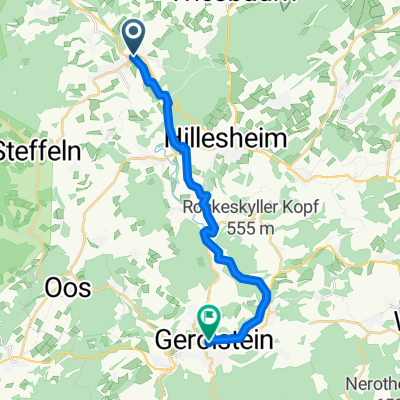
Kylltalradweg Part 2
A cycling route starting in Birgel, Rhineland-Palatinate, Germany.
Overview
About this route
Gut ausgeschilderte Kyllroute von Birgel nach Gondorf
- -:--
- Duration
- 58.3 km
- Distance
- 305 m
- Ascent
- 452 m
- Descent
- ---
- Avg. speed
- ---
- Max. altitude

Route quality
Waytypes & surfaces along the route
Waytypes
Path
14.9 km
(26 %)
Quiet road
13.6 km
(23 %)
Surfaces
Paved
53.5 km
(92 %)
Unpaved
0.3 km
(<1 %)
Asphalt
49.5 km
(85 %)
Paved (undefined)
3.4 km
(6 %)
Continue with Bikemap
Use, edit, or download this cycling route
You would like to ride Kylltalradweg Part 2 or customize it for your own trip? Here is what you can do with this Bikemap route:
Free features
- Save this route as favorite or in collections
- Copy & plan your own version of this route
- Sync your route with Garmin or Wahoo
Premium features
Free trial for 3 days, or one-time payment. More about Bikemap Premium.
- Navigate this route on iOS & Android
- Export a GPX / KML file of this route
- Create your custom printout (try it for free)
- Download this route for offline navigation
Discover more Premium features.
Get Bikemap PremiumFrom our community
Other popular routes starting in Birgel
 Monschau gerolstein
- Distance
- 93.9 km
- Ascent
- 840 m
- Descent
- 879 m
- Location
- Birgel, Rhineland-Palatinate, Germany
 1. Etappe CM Birgel-Dudeldorf
- Distance
- 57.3 km
- Ascent
- 471 m
- Descent
- 595 m
- Location
- Birgel, Rhineland-Palatinate, Germany
 Birgel-Hilgerath-Birgel
- Distance
- 64.2 km
- Ascent
- 650 m
- Descent
- 650 m
- Location
- Birgel, Rhineland-Palatinate, Germany
 Kylltalradweg Part 2
- Distance
- 58.3 km
- Ascent
- 293 m
- Descent
- 432 m
- Location
- Birgel, Rhineland-Palatinate, Germany
 Aachen - Trier via Kylltal: 2, Etappe Birgel - Trier-Tarforst
- Distance
- 97.6 km
- Ascent
- 452 m
- Descent
- 596 m
- Location
- Birgel, Rhineland-Palatinate, Germany
 MB-Tour
- Distance
- 153.9 km
- Ascent
- 552 m
- Descent
- 837 m
- Location
- Birgel, Rhineland-Palatinate, Germany
 Eifel Höhenwed und Kylltal Part 1
- Distance
- 64.8 km
- Ascent
- 519 m
- Descent
- 519 m
- Location
- Birgel, Rhineland-Palatinate, Germany
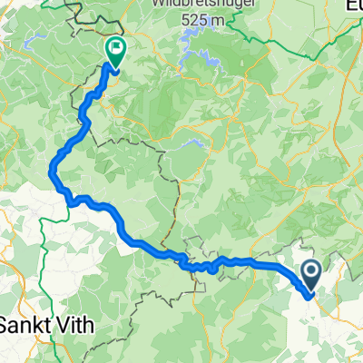 Hillesheim - Bütgenbacher See - Konzen
- Distance
- 68.5 km
- Ascent
- 437 m
- Descent
- 311 m
- Location
- Birgel, Rhineland-Palatinate, Germany
Open it in the app