

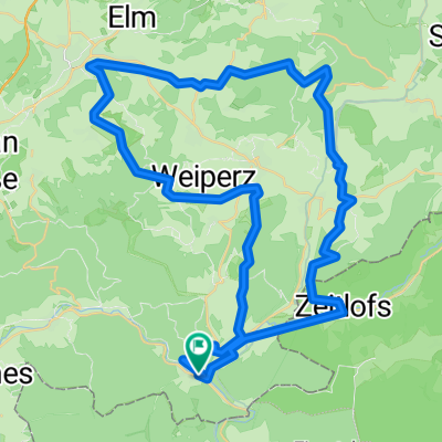
Schondratal
A cycling route starting in Obersinn, Bavaria, Germany.
Overview
About this route
Ausgangspunkt dieser schöenen Mountainbiketour ist Dittenbrunn.Gleich am Anfang steht ein steiler Anstieg nach Roßbach bevor. Von Roßbach aus folgt eine rasante Abfahrt hinunter nach Heiligkreuz. Der weitere Tourverlauf folgt dem kleinen Bach Schondra durch das schöne und ruhige Schondratal bis hin nach Gräfendorf. Von Gräfendorf bis nach Schonderfeld geht es kurz an der fränkischen Saale entlang ehe wieder ein steiler Anstieg hinauf zur Hochstaße ansteht. Nun folgt man der Hochstraße bis kurz vor Roßbach bevor wieder eine rasante Abfahrt zum Ausganspunkt ansteht.
- -:--
- Duration
- 52.9 km
- Distance
- 657 m
- Ascent
- 657 m
- Descent
- ---
- Avg. speed
- ---
- Max. altitude
Continue with Bikemap
Use, edit, or download this cycling route
You would like to ride Schondratal or customize it for your own trip? Here is what you can do with this Bikemap route:
Free features
- Save this route as favorite or in collections
- Copy & plan your own version of this route
- Sync your route with Garmin or Wahoo
Premium features
Free trial for 3 days, or one-time payment. More about Bikemap Premium.
- Navigate this route on iOS & Android
- Export a GPX / KML file of this route
- Create your custom printout (try it for free)
- Download this route for offline navigation
Discover more Premium features.
Get Bikemap PremiumFrom our community
Other popular routes starting in Obersinn
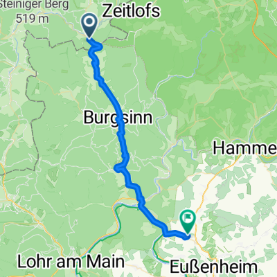
 Route from Honigrückweg 2, Sinntal
- Distance
- 29.1 km
- Ascent
- 407 m
- Descent
- 472 m
- Location
- Obersinn, Bavaria, Germany
 2009 Jossa-Werntal
- Distance
- 35 km
- Ascent
- 155 m
- Descent
- 245 m
- Location
- Obersinn, Bavaria, Germany
 Besuch an der Buhne
- Distance
- 72.7 km
- Ascent
- 511 m
- Descent
- 511 m
- Location
- Obersinn, Bavaria, Germany
 Climb ´em all
- Distance
- 53.4 km
- Ascent
- 1,030 m
- Descent
- 1,030 m
- Location
- Obersinn, Bavaria, Germany
 Jossa-Gemünde-Jossa (Sinntal)
- Distance
- 87.2 km
- Ascent
- 552 m
- Descent
- 552 m
- Location
- Obersinn, Bavaria, Germany
 2013 Jossa-Morlesau (Sinntal-Fränkische Saale)
- Distance
- 55.4 km
- Ascent
- 201 m
- Descent
- 239 m
- Location
- Obersinn, Bavaria, Germany
 Jossa - Bad Brückenau - Bischofsheim
- Distance
- 44.3 km
- Ascent
- 564 m
- Descent
- 344 m
- Location
- Obersinn, Bavaria, Germany
 Obersinn-SLÜ-Fulda-Bad Hersfeld-Kassel-Hann.Münden
- Distance
- 237.6 km
- Ascent
- 530 m
- Descent
- 592 m
- Location
- Obersinn, Bavaria, Germany
Open it in the app