

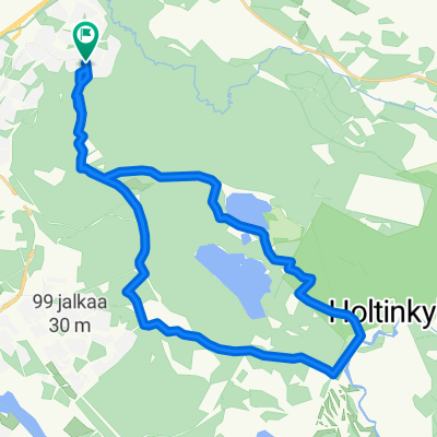
oulu - keminmaa
A cycling route starting in Oulu, North Ostrobothnia, Finland.
Overview
About this route
- 7 h 58 min
- Duration
- 131 km
- Distance
- 360 m
- Ascent
- 354 m
- Descent
- 16.5 km/h
- Avg. speed
- ---
- Max. altitude

Continue with Bikemap
Use, edit, or download this cycling route
You would like to ride oulu - keminmaa or customize it for your own trip? Here is what you can do with this Bikemap route:
Free features
- Save this route as favorite or in collections
- Copy & plan your own version of this route
- Split it into stages to create a multi-day tour
- Sync your route with Garmin or Wahoo
Premium features
Free trial for 3 days, or one-time payment. More about Bikemap Premium.
- Navigate this route on iOS & Android
- Export a GPX / KML file of this route
- Create your custom printout (try it for free)
- Download this route for offline navigation
Discover more Premium features.
Get Bikemap PremiumFrom our community
Other popular routes starting in Oulu
 Suomi-neidon ympäriajo
- Distance
- 5,053.3 km
- Ascent
- 0 m
- Descent
- 0 m
- Location
- Oulu, North Ostrobothnia, Finland
 Tour de 2020
- Distance
- 906.6 km
- Ascent
- 608 m
- Descent
- 500 m
- Location
- Oulu, North Ostrobothnia, Finland
 oulu - keminmaa
- Distance
- 131 km
- Ascent
- 360 m
- Descent
- 354 m
- Location
- Oulu, North Ostrobothnia, Finland
 0039 EuroVelo 10 Day 21
- Distance
- 111.8 km
- Ascent
- 0 m
- Descent
- 0 m
- Location
- Oulu, North Ostrobothnia, Finland
 Oulu Raahe
- Distance
- 96.6 km
- Ascent
- 53 m
- Descent
- 35 m
- Location
- Oulu, North Ostrobothnia, Finland
 pyhäjoki - oulu
- Distance
- 118.1 km
- Ascent
- 256 m
- Descent
- 259 m
- Location
- Oulu, North Ostrobothnia, Finland
 Marionin kauha v2
- Distance
- 145 km
- Ascent
- 129 m
- Descent
- 129 m
- Location
- Oulu, North Ostrobothnia, Finland
 Talvikangas-Sanginjoki
- Distance
- 18.2 km
- Ascent
- 23 m
- Descent
- 21 m
- Location
- Oulu, North Ostrobothnia, Finland
Open it in the app