

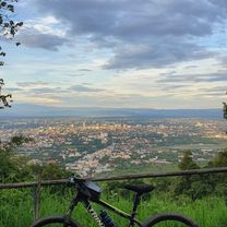
Doi Suthep climg
A cycling route starting in Chiang Mai, Chiang Mai, Thailand.
Overview
About this route
Out and back from Ping River to Doi Suthep.
- -:--
- Duration
- 34.4 km
- Distance
- 713 m
- Ascent
- 707 m
- Descent
- ---
- Avg. speed
- ---
- Max. altitude
Route quality
Waytypes & surfaces along the route
Waytypes
Quiet road
4.1 km
(12 %)
Access road
1 km
(3 %)
Surfaces
Paved
33.8 km
(98 %)
Unpaved
0.3 km
(1 %)
Asphalt
31.3 km
(91 %)
Concrete
1.7 km
(5 %)
Continue with Bikemap
Use, edit, or download this cycling route
You would like to ride Doi Suthep climg or customize it for your own trip? Here is what you can do with this Bikemap route:
Free features
- Save this route as favorite or in collections
- Copy & plan your own version of this route
- Sync your route with Garmin or Wahoo
Premium features
Free trial for 3 days, or one-time payment. More about Bikemap Premium.
- Navigate this route on iOS & Android
- Export a GPX / KML file of this route
- Create your custom printout (try it for free)
- Download this route for offline navigation
Discover more Premium features.
Get Bikemap PremiumFrom our community
Other popular routes starting in Chiang Mai
 Chiangmai U to Doi Su Thep view point
- Distance
- 18.1 km
- Ascent
- 404 m
- Descent
- 403 m
- Location
- Chiang Mai, Chiang Mai, Thailand
 Chiang Mai - Rim Ping
- Distance
- 65 km
- Ascent
- 30 m
- Descent
- 29 m
- Location
- Chiang Mai, Chiang Mai, Thailand
 Cycle in Thai 03 : Chiang Rai, Myanmar
- Distance
- 263.6 km
- Ascent
- 781 m
- Descent
- 703 m
- Location
- Chiang Mai, Chiang Mai, Thailand
 DoiSuthep
- Distance
- 49.9 km
- Ascent
- 1,107 m
- Descent
- 1,109 m
- Location
- Chiang Mai, Chiang Mai, Thailand
 straight to samoeng
- Distance
- 41.2 km
- Ascent
- 1,028 m
- Descent
- 849 m
- Location
- Chiang Mai, Chiang Mai, Thailand
 MHS Loop
- Distance
- 533.7 km
- Ascent
- 5,294 m
- Descent
- 5,289 m
- Location
- Chiang Mai, Chiang Mai, Thailand
 MTCM - ITT Huay Tung Thao Lake
- Distance
- 8.3 km
- Ascent
- 72 m
- Descent
- 78 m
- Location
- Chiang Mai, Chiang Mai, Thailand
 Phuping Palace
- Distance
- 52.2 km
- Ascent
- 1,083 m
- Descent
- 1,098 m
- Location
- Chiang Mai, Chiang Mai, Thailand
Open it in the app