

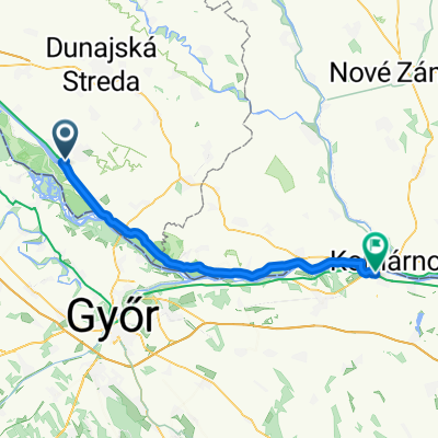
Šuľany / Horný Bar - Gabčíkovo
A cycling route starting in Gabčíkovo, Trnava Region, Slovakia.
Overview
About this route
- 22 min
- Duration
- 10.9 km
- Distance
- 61 m
- Ascent
- 64 m
- Descent
- 30.3 km/h
- Avg. speed
- ---
- Max. altitude
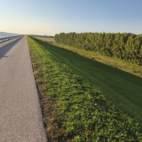
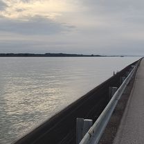
Route photos


Route quality
Waytypes & surfaces along the route
Waytypes
Cycleway
10.2 km
(93 %)
Road
0.4 km
(4 %)
Surfaces
Paved
10.9 km
(100 %)
Asphalt
10.9 km
(100 %)
Continue with Bikemap
Use, edit, or download this cycling route
You would like to ride Šuľany / Horný Bar - Gabčíkovo or customize it for your own trip? Here is what you can do with this Bikemap route:
Free features
- Save this route as favorite or in collections
- Copy & plan your own version of this route
- Sync your route with Garmin or Wahoo
Premium features
Free trial for 3 days, or one-time payment. More about Bikemap Premium.
- Navigate this route on iOS & Android
- Export a GPX / KML file of this route
- Create your custom printout (try it for free)
- Download this route for offline navigation
Discover more Premium features.
Get Bikemap PremiumFrom our community
Other popular routes starting in Gabčíkovo
 Baka - Baka
- Distance
- 33.6 km
- Ascent
- 21 m
- Descent
- 71 m
- Location
- Gabčíkovo, Trnava Region, Slovakia
 Baka - Baka
- Distance
- 31.9 km
- Ascent
- 34 m
- Descent
- 80 m
- Location
- Gabčíkovo, Trnava Region, Slovakia
 Narad - Patince Alt Road
- Distance
- 74.2 km
- Ascent
- 19 m
- Descent
- 22 m
- Location
- Gabčíkovo, Trnava Region, Slovakia
 Gabčíkovo_Komárno
- Distance
- 50.9 km
- Ascent
- 25 m
- Descent
- 27 m
- Location
- Gabčíkovo, Trnava Region, Slovakia
 GAB1
GAB1- Distance
- 37.9 km
- Ascent
- 15 m
- Descent
- 16 m
- Location
- Gabčíkovo, Trnava Region, Slovakia
 Bős-Lipót-Bős
- Distance
- 98.9 km
- Ascent
- 15 m
- Descent
- 24 m
- Location
- Gabčíkovo, Trnava Region, Slovakia
 Gabčíkovo - Párkány
- Distance
- 108.3 km
- Ascent
- 138 m
- Descent
- 143 m
- Location
- Gabčíkovo, Trnava Region, Slovakia
 Dunajská, Gabčíkovo nach Szt László utca, Komárom
- Distance
- 52.7 km
- Ascent
- 68 m
- Descent
- 68 m
- Location
- Gabčíkovo, Trnava Region, Slovakia
Open it in the app