


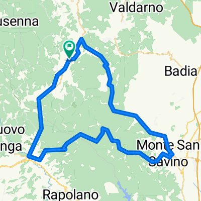
Badia-Siena-Badia
A cycling route starting in Ambra, Tuscany, Italy.
Overview
About this route
1
A tour to Siena is always worth it. Unfortunately, a city tour by bike is not recommended. You don't know where to put the bike and the return trip leaves little time for visiting this beautiful city.
- -:--
- Duration
- 95.2 km
- Distance
- 1,186 m
- Ascent
- 1,158 m
- Descent
- ---
- Avg. speed
- 393 m
- Max. altitude
RadlKurt
created this 17 years ago
Route quality
Waytypes & surfaces along the route
Waytypes
Road
35.2 km
37 %
Quiet road
13.3 km
14 %
Surfaces
Paved
70.4 km
(74 %)
Unpaved
8.6 km
(9 %)
Asphalt
68.5 km
72 %
Gravel
2.9 km
3 %
Continue with Bikemap
Use, edit, or download this cycling route
You would like to ride Badia-Siena-Badia or customize it for your own trip? Here is what you can do with this Bikemap route:
Free features
- Save this route as favorite or in collections
- Copy & plan your own version of this route
- Split it into stages to create a multi-day tour
- Sync your route with Garmin or Wahoo
Premium features
Free trial for 3 days, or one-time payment. More about Bikemap Premium.
- Navigate this route on iOS & Android
- Export a GPX / KML file of this route
- Create your custom printout (try it for free)
- Download this route for offline navigation
Discover more Premium features.
Get Bikemap PremiumFrom our community
Other popular routes starting in Ambra


 Circle one - Ambra - San Pancrazio - Monte S.Savino - Palazzuolo - Colonna del Grillo - Ambra0
- 56 km
- 645 m
- 646 m
- Ambra, Tuscany, Italy


Open it in the app