

kam s jakto...
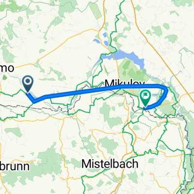
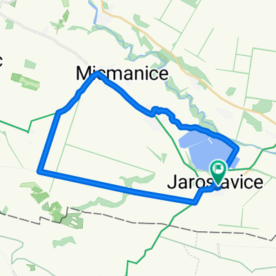
A cycling route starting in Jaroslavice, South Moravian, Czechia.
Overview
About this route
- -:--
- Duration
- 160.3 km
- Distance
- 448 m
- Ascent
- 253 m
- Descent
- ---
- Avg. speed
- ---
- Max. altitude
Route quality
Waytypes & surfaces along the route
Waytypes
Road
51.3 km
(32 %)
Quiet road
9.6 km
(6 %)
Surfaces
Paved
99.4 km
(62 %)
Asphalt
99.4 km
(62 %)
Undefined
60.9 km
(38 %)
Route highlights
Points of interest along the route
Point of interest after 0 km
hrad Okoř
Point of interest after 0 km
Sněžka
Point of interest after 0 km
hrad Kost
Point of interest after 0 km
Sklařské muzeum
Point of interest after 0 km
Sklařské muzeum, kamenický Šenov
Point of interest after 0 km
zámek Libochovice
Point of interest after 0 km
hrad Valečov
Point of interest after 0 km
skanzen Přerov nad Labem
Point of interest after 0 km
štola sv.Martina Krupka
Point of interest after 0 km
botanická zahrada Teplice
Point of interest after 0 km
ZOO Usti nad Labem
Point of interest after 0 km
ZOO Liberec
Point of interest after 0 km
zámek Duchcov
Point of interest after 0 km
zámek Ploskovice
Point of interest after 0 km
park Průhonice
Point of interest after 0 km
vodní mlýn Slup
Point of interest after 0 km
zámek Mělník
Point of interest after 0 km
muzeum lidových staveb Kouřim
Point of interest after 0.2 km
zámek Dobříš
Point of interest after 0.2 km
sklárny Nížbor
Point of interest after 0.2 km
Chrustenická šachta, Chrustenice
Point of interest after 32.1 km
Teplické skály
Point of interest after 32.1 km
zámek Rosice
Point of interest after 48.3 km
zámek Mikulov
Point of interest after 49.7 km
jeskyně Na Turoldu
Point of interest after 59.2 km
jeskyně Blanických rytířů
Point of interest after 59.2 km
chata Hvězda Broumovské skály
Point of interest after 59.5 km
muzeum Dolní Věstonice
Point of interest after 59.8 km
zámek Boskovice
Point of interest after 60.2 km
stará huť Adamov
Point of interest after 61.1 km
Javořičské jeskyně
Point of interest after 78.1 km
Minaret Lednice
Point of interest after 82.9 km
Janův hrad Lednice
Point of interest after 108.4 km
Slovanské hradiště Mikulčice
Point of interest after 120.5 km
ZOO Hodonin
Point of interest after 128.1 km
ruční papírna Velké Losiny
Point of interest after 140.2 km
Baťův kanál Strážnice
Point of interest after 140.3 km
skanzen Stražnice
Point of interest after 146.2 km
Sovinec
Point of interest after 146.2 km
ZOO Olomouc
Point of interest after 146.2 km
zlatorudné mlýny Zlaté Hory
Point of interest after 147.3 km
zámek Bruntál
Point of interest after 153 km
hrad Malenovice
Point of interest after 156.6 km
chata Na Prašivé
Point of interest after 160.3 km
větrný mlýn Kuželov
Continue with Bikemap
Use, edit, or download this cycling route
You would like to ride kam s jakto... or customize it for your own trip? Here is what you can do with this Bikemap route:
Free features
- Save this route as favorite or in collections
- Copy & plan your own version of this route
- Split it into stages to create a multi-day tour
- Sync your route with Garmin or Wahoo
Premium features
Free trial for 3 days, or one-time payment. More about Bikemap Premium.
- Navigate this route on iOS & Android
- Export a GPX / KML file of this route
- Create your custom printout (try it for free)
- Download this route for offline navigation
Discover more Premium features.
Get Bikemap PremiumFrom our community
Other popular routes starting in Jaroslavice
 Triko
Triko- Distance
- 141.1 km
- Ascent
- 358 m
- Descent
- 412 m
- Location
- Jaroslavice, South Moravian, Czechia
 NJKČR - 1. etapa
- Distance
- 71.7 km
- Ascent
- 208 m
- Descent
- 247 m
- Location
- Jaroslavice, South Moravian, Czechia
 Trénink na Valtické cyklobraní Kooperativy
- Distance
- 53 km
- Ascent
- 286 m
- Descent
- 182 m
- Location
- Jaroslavice, South Moravian, Czechia
 kam s jakto...
- Distance
- 160.3 km
- Ascent
- 448 m
- Descent
- 253 m
- Location
- Jaroslavice, South Moravian, Czechia
 07a-Jaroslavice-ZnojmoCD
- Distance
- 18.8 km
- Ascent
- 162 m
- Descent
- 88 m
- Location
- Jaroslavice, South Moravian, Czechia
 1. Etapa - Křídlůvky - Pohansko
- Distance
- 74 km
- Ascent
- 201 m
- Descent
- 233 m
- Location
- Jaroslavice, South Moravian, Czechia
 Jaroslavice - Valtice
- Distance
- 57.8 km
- Ascent
- 90 m
- Descent
- 83 m
- Location
- Jaroslavice, South Moravian, Czechia
 Jaroslavice-Sloup
- Distance
- 21.9 km
- Ascent
- 121 m
- Descent
- 119 m
- Location
- Jaroslavice, South Moravian, Czechia
Open it in the app