

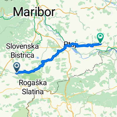
Ptuj-Maribor-Poljčane
A cycling route starting in Poljčane, Občina Poljčane, Slovenia.
Overview
About this route
17.04.2011 smo se iz Poljčan popeljali Tina, Dule in jaz v prekrasnem a malce svežem popoldnevu proti Makolam, kjer sta se nam pridružila Leon in Striko. Sama pot je v glavnem ravninska, le Ptujska gora in Vurberk sta malenkost višja. Pa še ta vzpona sta meni kar ponagajala, saj letos še praktično nimam kaj dosti prevoženih Km. V Apačah smo morali imeti tudi nepredvideni daljši postanek, saj je Leonu nekoliko ponagajalo srce, zato smo tudi nadaljni tempo priredili.
Sama pot je dokaj slikovita, asfalt dober, saj gre le za medkrajevne ceste. Le odsek Makole-Pečke je katastrofa. Gre za dobra 2 Km ˝asfaltirane˝ slabši makadam ceste.
Sama vožnja je potekala z moje strani solidno
- -:--
- Duration
- 87.1 km
- Distance
- 361 m
- Ascent
- 362 m
- Descent
- ---
- Avg. speed
- ---
- Max. altitude

Route quality
Waytypes & surfaces along the route
Waytypes
Road
26.1 km
(30 %)
Quiet road
10.4 km
(12 %)
Surfaces
Paved
61 km
(70 %)
Asphalt
61 km
(70 %)
Undefined
26.1 km
(30 %)
Route highlights
Points of interest along the route

Point of interest after 4 km
skozi Studenice

Point of interest after 7.6 km
in Globoko

Point of interest after 10 km
smer Makole

Point of interest after 12 km
v Pečkah se pridružita Striko in Leon

Point of interest after 15.4 km
prestop občinske meje

Point of interest after 17.1 km
vzpon na Ptujsko goro

Point of interest after 20.3 km
cerkev na Ptujski gori

Point of interest after 23.6 km
po spustu iz Ptujske gore skozi Lovrenc na dravskem polju

Point of interest after 30.1 km
skozi Zg.Hajdino

Point of interest after 33.4 km
na Ptujskem mostu

Point of interest after 39.9 km
proti Vurberku

Point of interest after 45 km
na Vurberškem klancu

Point of interest after 45.8 km
spust proti Dvorjanam

Point of interest after 54.2 km
preko dravskega kanala do Tezna

Point of interest after 57.5 km
O.Š. Martina Konšaka na Teznu

Point of interest after 68 km
skozi Radizel

Point of interest after 75.4 km
vzpon na Klopce

Point of interest after 78 km
še vzpon na Jožefov hrib

Point of interest after 83.6 km
in na Križni vrh

Point of interest after 86.8 km
pa smo doma
Continue with Bikemap
Use, edit, or download this cycling route
You would like to ride Ptuj-Maribor-Poljčane or customize it for your own trip? Here is what you can do with this Bikemap route:
Free features
- Save this route as favorite or in collections
- Copy & plan your own version of this route
- Split it into stages to create a multi-day tour
- Sync your route with Garmin or Wahoo
Premium features
Free trial for 3 days, or one-time payment. More about Bikemap Premium.
- Navigate this route on iOS & Android
- Export a GPX / KML file of this route
- Create your custom printout (try it for free)
- Download this route for offline navigation
Discover more Premium features.
Get Bikemap PremiumFrom our community
Other popular routes starting in Poljčane
 krog do Maribora
- Distance
- 71.2 km
- Ascent
- 235 m
- Descent
- 232 m
- Location
- Poljčane, Občina Poljčane, Slovenia
 Poljčane - Zavrč
- Distance
- 54.4 km
- Ascent
- 411 m
- Descent
- 470 m
- Location
- Poljčane, Občina Poljčane, Slovenia
 STKP - Velikonočnica - Boč - Ljubična gora
- Distance
- 21.2 km
- Ascent
- 339 m
- Descent
- 339 m
- Location
- Poljčane, Občina Poljčane, Slovenia
 MTB: Poljčane - Boč (Stolp)
- Distance
- 26.2 km
- Ascent
- 934 m
- Descent
- 938 m
- Location
- Poljčane, Občina Poljčane, Slovenia
 Zbelovo - Celjska Koča
- Distance
- 36 km
- Ascent
- 730 m
- Descent
- 376 m
- Location
- Poljčane, Občina Poljčane, Slovenia
 Loče - Ribniki Jernej - Lubicno - Loče
- Distance
- 17 km
- Ascent
- 368 m
- Descent
- 369 m
- Location
- Poljčane, Občina Poljčane, Slovenia
 MTB: Poljčane - Boč - Poljčane
- Distance
- 18.7 km
- Ascent
- 842 m
- Descent
- 842 m
- Location
- Poljčane, Občina Poljčane, Slovenia
 Okoli Boča
- Distance
- 23.1 km
- Ascent
- 932 m
- Descent
- 936 m
- Location
- Poljčane, Občina Poljčane, Slovenia
Open it in the app