

Vuelta a Paniza, Virgen del Aguila, Codos y Almonacid
A cycling route starting in Longares, Aragon, Spain.
Overview
About this route
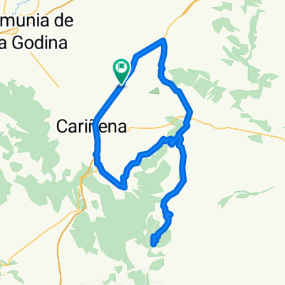
Terreno rompepiernas por la Sierra de Algairén, con dos puertos largos (Paniza con la Ermita de la Virgen del Aguila y Codos), y terreno ondulado al final. Carreteras en buen estado.
Unico tramo con algo de precaución la zona de Aguarón a Almonacid, caminos de viñas.
- -:--
- Duration
- 98.7 km
- Distance
- 994 m
- Ascent
- 992 m
- Descent
- ---
- Avg. speed
- 1,002 m
- Max. altitude

Route quality
Waytypes & surfaces along the route
Waytypes
Quiet road
30.4 km
(31 %)
Cycleway
16.6 km
(17 %)
Surfaces
Paved
10.9 km
(11 %)
Unpaved
2.3 km
(2 %)
Asphalt
9.4 km
(10 %)
Unpaved (undefined)
2.2 km
(2 %)
Continue with Bikemap
Use, edit, or download this cycling route
You would like to ride Vuelta a Paniza, Virgen del Aguila, Codos y Almonacid or customize it for your own trip? Here is what you can do with this Bikemap route:
Free features
- Save this route as favorite or in collections
- Copy & plan your own version of this route
- Split it into stages to create a multi-day tour
- Sync your route with Garmin or Wahoo
Premium features
Free trial for 3 days, or one-time payment. More about Bikemap Premium.
- Navigate this route on iOS & Android
- Export a GPX / KML file of this route
- Create your custom printout (try it for free)
- Download this route for offline navigation
Discover more Premium features.
Get Bikemap PremiumFrom our community
Other popular routes starting in Longares
 Sierra de Algairen - Longares, Torralbilla, Santa Cruz, Alto de Miedes, Codos, Longares.
- Distance
- 137.1 km
- Ascent
- 2,046 m
- Descent
- 2,050 m
- Location
- Longares, Aragon, Spain
 Vuelta a Paniza, Virgen del Aguila, Codos y Almonacid
- Distance
- 98.7 km
- Ascent
- 994 m
- Descent
- 992 m
- Location
- Longares, Aragon, Spain
 1ª ETAPA CHALLENGE ARAGON MASTER 2013
- Distance
- 8.6 km
- Ascent
- 64 m
- Descent
- 14 m
- Location
- Longares, Aragon, Spain
 Longares-Codos-Paniza-Longares
- Distance
- 71.4 km
- Ascent
- 881 m
- Descent
- 881 m
- Location
- Longares, Aragon, Spain
 CAMPEONATO ARAGON MASTER
- Distance
- 72.7 km
- Ascent
- 872 m
- Descent
- 873 m
- Location
- Longares, Aragon, Spain
 Sierra de Algairen y El Frasno
- Distance
- 151.8 km
- Ascent
- 1,554 m
- Descent
- 1,554 m
- Location
- Longares, Aragon, Spain
 Puertos en Sierra Algairen
- Distance
- 137.4 km
- Ascent
- 1,945 m
- Descent
- 1,945 m
- Location
- Longares, Aragon, Spain
 Longares-Mezalocha-Aguilon-Virgen de Herrera-Tosos-Paniza-Longares
- Distance
- 120.4 km
- Ascent
- 1,030 m
- Descent
- 1,034 m
- Location
- Longares, Aragon, Spain
Open it in the app