

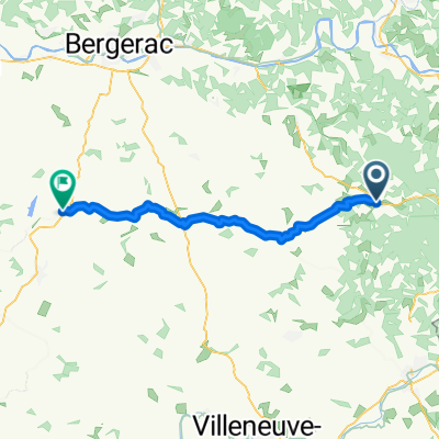
dag 3: Villeréal - Grézels
A cycling route starting in Villeréal, Nouvelle-Aquitaine, France.
Overview
About this route
0
Day 3: Villeréal - Grézels
- -:--
- Duration
- 58.2 km
- Distance
- 348 m
- Ascent
- 347 m
- Descent
- ---
- Avg. speed
- 200 m
- Max. altitude
Route quality
Waytypes & surfaces along the route
Waytypes
Road
25 km
43 %
Quiet road
11.6 km
20 %
Surfaces
Paved
6.4 km
(11 %)
Unpaved
3.5 km
(6 %)
Asphalt
6.4 km
11 %
Gravel
3.5 km
6 %
Undefined
48.3 km
83 %
Continue with Bikemap
Use, edit, or download this cycling route
You would like to ride dag 3: Villeréal - Grézels or customize it for your own trip? Here is what you can do with this Bikemap route:
Free features
- Save this route as favorite or in collections
- Copy & plan your own version of this route
- Sync your route with Garmin or Wahoo
Premium features
Free trial for 3 days, or one-time payment. More about Bikemap Premium.
- Navigate this route on iOS & Android
- Export a GPX / KML file of this route
- Create your custom printout (try it for free)
- Download this route for offline navigation
Discover more Premium features.
Get Bikemap PremiumFrom our community
Other popular routes starting in Villeréal
- 20 Place du Foirail Nord, Monpazier à Rue du Mondalou, Saint-Pompont0
- 26.6 km
- 279 m
- 340 m
- Villeréal, Nouvelle-Aquitaine, France
- De D676 11, Villeréal à Rue du 1er Septembre 1944 13, Boncourt-sur-Meuse0
- 755.2 km
- 7,030 m
- 6,903 m
- Villeréal, Nouvelle-Aquitaine, France


Open it in the app