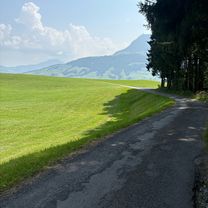
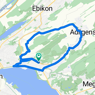
Erich‘s Surprise-Tour 2.0 (Richtung Sins)
- 98.1 km
- 1,016 m
- 977 m
- Adligenswil, Canton of Lucerne, Switzerland
A cycling route starting in Adligenswil, Canton of Lucerne, Switzerland.
Overview
created this 4 years ago


Route quality
Quiet road
20.8 km
(67 %)
Track
5.9 km
(19 %)
Paved
9.9 km
(32 %)
Unpaved
5.9 km
(19 %)
Asphalt
9.3 km
(30 %)
Gravel
4.7 km
(15 %)
Continue with Bikemap
You would like to ride MTB-Tour Adligen, Seebodenalp, Holderen or customize it for your own trip? Here is what you can do with this Bikemap route:
Free trial for 3 days, or one-time payment. More about Bikemap Premium.
Discover more Premium features.
Get Bikemap PremiumFrom our community
Open it in the app