

Golets
A cycling route starting in Nantua, Auvergne-Rhône-Alpes, France.
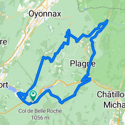
Overview
About this route
- -:--
- Duration
- 56.6 km
- Distance
- 1,069 m
- Ascent
- 1,072 m
- Descent
- ---
- Avg. speed
- ---
- Max. altitude
Route highlights
Points of interest along the route
Point of interest after 7.9 km
Col de Colliard
Point of interest after 8.5 km
Golet à la Borne
Point of interest after 10.4 km
Golet au Loup
Point of interest after 11.2 km
Golet du Bret
Point of interest after 12.3 km
Golet à la Chèvre
Point of interest after 14.1 km
Golet Brunet
Point of interest after 21.9 km
Col de la Cheminée
Point of interest after 27.7 km
Golet Belon
Point of interest after 32.5 km
Golet Géla
Point of interest after 33.8 km
Golet Comment
Point of interest after 34.7 km
Golet Burgon
Point of interest after 36.7 km
Golet au Rouge
Point of interest after 41.2 km
Golet Sapin
Point of interest after 42.5 km
Golet Blanchet
Point of interest after 43.4 km
Golet Boquin
Point of interest after 46 km
Col de Belle Roche
Point of interest after 47.6 km
Golet de la Frasse
Continue with Bikemap
Use, edit, or download this cycling route
You would like to ride Golets or customize it for your own trip? Here is what you can do with this Bikemap route:
Free features
- Save this route as favorite or in collections
- Copy & plan your own version of this route
- Sync your route with Garmin or Wahoo
Premium features
Free trial for 3 days, or one-time payment. More about Bikemap Premium.
- Navigate this route on iOS & Android
- Export a GPX / KML file of this route
- Create your custom printout (try it for free)
- Download this route for offline navigation
Discover more Premium features.
Get Bikemap PremiumFrom our community
Other popular routes starting in Nantua
 De 311 Rue de la Gélinotte, Nantua à 297 Rue de la Gélinotte, Nantua
- Distance
- 15.3 km
- Ascent
- 57 m
- Descent
- 52 m
- Location
- Nantua, Auvergne-Rhône-Alpes, France
 Jura 8 Col Loop
- Distance
- 83.9 km
- Ascent
- 1,562 m
- Descent
- 1,561 m
- Location
- Nantua, Auvergne-Rhône-Alpes, France
 Jura Col Hunting via Trails
- Distance
- 63 km
- Ascent
- 1,280 m
- Descent
- 1,280 m
- Location
- Nantua, Auvergne-Rhône-Alpes, France
 2020-06-07 / Haut Bugey - Plateau du Retord
- Distance
- 56.7 km
- Ascent
- 3,182 m
- Descent
- 3,186 m
- Location
- Nantua, Auvergne-Rhône-Alpes, France
 circ 24 AIN
- Distance
- 85.8 km
- Ascent
- 1,377 m
- Descent
- 1,375 m
- Location
- Nantua, Auvergne-Rhône-Alpes, France
 Nantua - Monts de l'Ain
- Distance
- 89.8 km
- Ascent
- 1,567 m
- Descent
- 1,568 m
- Location
- Nantua, Auvergne-Rhône-Alpes, France
 Jura Col Hunting
- Distance
- 90.6 km
- Ascent
- 1,282 m
- Descent
- 1,282 m
- Location
- Nantua, Auvergne-Rhône-Alpes, France
 Lac Genin Loop
- Distance
- 57.2 km
- Ascent
- 1,246 m
- Descent
- 1,208 m
- Location
- Nantua, Auvergne-Rhône-Alpes, France
Open it in the app